Showing posts with label Missouri public lands. Show all posts

Thursday, October 14, 2010

Getting Out of Dodge: To Paris, Florida, Santa Fe, Mexico . . .

Last weekend was the homecoming for Lincoln University, and since we live near downtown and on a major beeline to the university, our home promised even less solace and solitude than usual. Lots of cars. And honestly? I've been needing to get away. The interior of the house reflects the mess inside my head, and I live and work at home. I needed to get out of my cage.

Friday night was a big Lincoln homecoming shindig with fireworks--fun to watch from our third-floor windows--but the steady traffic on Broadway and the expressway, the sirens of numerous emergency vehicles, and voices of passersby below our windows kept us up late.

Saturday would begin with the big parade. We decided to get out of town before all that even started.


We were planning just a quick morning trip to the Pinnacles Youth Park north of Columbia, but as it turned out, we kept going . . .

You know how it is. Sometimes, once you start driving away from your house, your work, you just keep going. You can't stop and turn around until you're exhausted, until the idea of your own bed starts sounding like a good idea again.

It was a big loop, and when I tell you where we went, you'll laugh. Look how far we got!

Paris . . . Florida . . . Santa Fe . . . Mexico. . . . We were like world travelers!

One of the reasons Missouri got such place-names was because this area was a major stepping-off point for westering travelers in the 1800s. Missouri also has a Taos, a Nevada (pronounced "nuh-VAY-duh," of course), a Louisiana, a California, and many others.

Amid our "intercontinental" travels yesterday, we also paid homage to perhaps the most famous Missourian ever: Samuel L. Clemens--Mark Twain.

We also learned a little about transportation history and engineering by visiting the Union Covered Bridge, our state's one surviving example of a Burr-arch truss bridge, now a Missouri State Historic Site.

I'm not going to go into much detail here, since there is already plenty of information available on other websites (links provided below). If you're in Columbia and are wanting to take a pleasant day trip over picturesque roads, this makes a nice loop and a varied day.


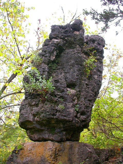
1. The Pinnacles Youth Park is about twelve miles north of Columbia on Highway 63. Allow yourself a couple of hours there to visit the nifty shelf cave and, best, to explore the pinnacles themselves. To do the latter, be prepared to clamber among big rocks high above the creek below. Acrophobes need not apply. Also, crossing the creek could potentially get your feet wet--be prepared for that.


2. North on 63, then east on Highway 22 to Centralia. North from Centralia on Route C to the Union Covered Bridge. Unlike Ohio and Indiana (for instance), Missouri doesn't have many surviving covered bridges (we have only four). This is the only one in Missouri with a Burr-arch truss design and horizontal siding, so it's extra special. It's in a peaceful setting near shimmering soybean fields, and an interpretive kiosk will educate you about how these bridges were designed. There are no picnic tables or trash cans, but this would be a pleasant place for lunch.


You'll notice in my photo that some siding is missing from the bridge. The DNR had to remove it in 2008 when a big flash flood threatened to destroy the bridge. They're currently trying to find funding to repair it.

3. North on C and east on 24 to Paris, Missouri. Paris is an attractive town with lovely historic homes. The banners on utility poles in Paris have a little picture of the Eiffel Tower on them, but that's about where visible connection to the City of Light ends. You will not find a single French restaurant in the city of Paris. There is a Subway, however. (I'm partial to the Cold Cut Combo; and to be honest, I wasn't in the mood for snails, anyway.)

4. From Paris, take Highway 154 east into Mark Twain State Park. Following signs for the Mark Twain Birthplace, head north on Route E. The Mark Twain Birthplace Shrine is in the state park, on a peninsula with a scenic view of Mark Twain Lake (a reservoir created by Clarence Cannon Dam, which impounded the Salt River). This would be another good place for a picnic lunch.


The humble, two-room clapboard house in which the author of America's most famous novel was born is sheltered by a modern structure with a sweeping, pointed roof. There is also a museum in the building with many artifacts of Twain's life (from furniture to original letters and manuscripts and much more) and an A/V presentation telling the story of Twain's life.

5. Florida, Missouri, the birthplace of Mark Twain, is very close to the Birthplace Shrine. A historical marker in this tiny town shows the original location of the little house where, during the 1835 visit of Halley's Comet, Mark Twain arrived into this world--a couple of months before he was expected. If you want to spend more time around here, there is a hiking trail nearby.

6. Retrace your route south on E to D, then west on D to Santa Fe. There isn't much here, folks. Just as there's no cuisine française in Paris, there isn't even a Taco Bell in Santa Fe. No place for nopales, or chili rellenos, or chili verde. There's not even a Subway. But here's a picture of the post office, to prove that we went to Santa Fe on Saturday.


7. From Santa Fe, continue west on D to Route ZZ. It's a scenic drive southwest on Route ZZ, which traces the Salt River. It joins briefly with Route Z before connecting to Highway 15, which you can take all the way to Mexico. Mexico is indeed a little south of Santa Fe, which is kinda fitting. Mexico, compared to the other places so far on this trip, is a bustling metropolis, with restaurants and everything. If you're looking for something to "do" there, the first, most natural thing, is to visit the Audrain County Historical Society Museum and its lovely, landscaped grounds, which include several other historic structures.


Mexico was famous for Tom Bass, a nationally known and respected horse breeder and trainer. The respect that people gave him during his life is more remarkable, given the time period, since he was black. Rex McDonald, a championship show horse, is buried on the park grounds.

There is also an interesting piece of machinery there--a brick-producing machine that was used in the early years by the A. P. Green Company, a manufacturer of bricks and one of Mexico's most important industries. The machine lies in state here, with a plaque from the company thanking it for its years of selfless, dedicated service. (I guess a gold watch wasn't very fitting.)


8. From Mexico, we drove south on Highway 54 through Auxvasse to I-70, and thence home. The sun was setting, and the bed was going to feel extra cozy after all that hiking, sight-seeing, and time in the driver's seat. Got me a snoot full of fresh air, I did.


Bonus Information You Just Have to Read!


People in Mexico, Missouri, insist that you not call them Mexicans. That term is reserved for people who are from the nation of Mexico. So, you might ask, what do people from Mexico, Missouri, call themselves? Mexicoans. That extra syllable makes all the difference.

Which means that a native of the country of Mexico, who is living in Mexico, Missouri, is a "Mexican Mexicoan."

Or! When you go to dinner at a Mexican restaurant in Mexico, Mo., technically, you are eating "Mexicoan Mexican food."

Or! When Senator Bond (who is from Mexico, Missouri) goes on a junket down to our neighbor to the south, he is a "Mexicoan visiting the Mexicans." Get it?

Meanwhile . . . I have it on very good authority that people in Paris, Missouri, are not called "Parisians." Indeed! Are you ready for this? They are--Parisites.

Sunday, October 10, 2010

The Devil's Backbone, Boone County, Missouri


Just southeast of Columbia, Missouri, is a remarkable place called the Devil's Backbone. Bring your camera, and put on your History Specs.

I'd never been to the area before (to my knowledge), so I made a point of seeing it.

First, it's small. The track is not even half a mile of old gravel road. We're not talking about miles of hiking trails here, not at all.

But the views!


The road straightforwardly descends a long, rocky-spined ridge that divides two sides of a big oxbow bend in Cedar Creek. The undulation of the rocky ridge is what inspired the place-name. There are some outcrops for vantage points. You get broad views of the landscape east and west (though mostly east, as the roadbed lies on the west side of the sharp ridge of rocks, which you can't always see over).


This time of year, "broad views of the landscape," especially in early mornings or late afternoons, are what afford you the best circumstances for enjoying the colors of autumn.


At the bottom of the road, you are about two hundred feet lower than the top of the ridge where you started. Toward the east is an old iron bridge, with all the wooden planks gone, still standing above Cedar Creek (you shouldn't try to cross it--but I'm not sure what's preventing you from wading some in the creek itself).


It is at this location, I've read, that a Duley's Mill used to be. Area farmers would travel here to get their grain processed, and the bridge provided Callawegians from the Kingdom of Callaway access to the mill from across the creek.


What a pleasant walk. Think about bringing some cheese and raisins, an apple, in the pockets of your jacket--having a snack will give you an excuse to linger and enjoy the place, the views, the dappled forest light, the placid creek.


But read this next bit, please.

Because it's small, and because it's flanked on all sides by private property (as in, Keep Out), I implore you to respect That Which Is Not Yours, and take care of the place as if your right to tread there depends on the condition in which you leave it.


Now. How do you get there? South of Columbia, or north of Jefferson City, take Route H east (that's the exit for Columbia Regional Airport). Follow Route H to the little community of Englewood. I think Route H technically ends there, but past Englewood the pavement continues as Englewood Road for about a mile before becoming gravel. Another half-mile or so of gravel, then take Backbone Road on the right. It's a smaller gravel road and leads south for about a mile. At that point, you can pull off the road (there's space for about two vehicles) and walk the rest of the way.


You'll know when you reach the place where you have to start walking, because the road suddenly plunges and looks like something fit for a four-wheel drive. This is it; this is where you start walking down to the creek.


The hike down that old gravel road is worth the drive to get out there. As you admire the views and the pretty wildflowers, and watch turkey vultures soaring above and below you, you can imagine horse-drawn wagons and Model A trucks slogging up and down this road bearing grain--I'll bet that's why it got named not just the Backbone, but the Devil's Backbone--because it must have been a devil of a haul.

Monday, October 4, 2010

Ha Ha Tonka State Park

October, the pinnacle of autumn, is probably the best month of the year to go outside and poke around in nature: The weather is great, the landscape breathtaking. A close runner-up for the award might be April, but for hiking October edges ahead because of the drier weather and superior trail conditions.


On September 26, our excursion was to Ha Ha Tonka State Park, arguably the crown jewel of the state park system. It “has it all,” and in an oversized way: Interesting human history ranging from aboriginal up to modern times; natural communities and a host of remarkable organisms; broad, wondrous views; hidden alcoves; and a range of options for accessibility and strenuousness.

Underlying its skin of soil and vegetation, this land offers a living encyclopedia of geologic wonders, a textbook of karst topography. A few miles of hiking can show you at least one example of just about every single type of karst feature: Caves (nineteen have been found so far within its borders), sinkholes, dramatic 250-foot bluffs, a chasm, a tremendous natural bridge, a pirated stream, fins and pinnacles, a balanced rock, and the state’s twelfth largest spring (48 million gallons a day), flowing into a gorgeous turquoise pool.

Formerly, there was a pleasant forty-acre fishing lake downstream of the spring, with rental cabins, boating, and bathing, but in 1931 the newly impounded Lake of the Ozarks swallowed it up.


The entire landscape is shaped by the partial collapse of an enormous cave system; all—including the original cave itself—sculpted over eons by the slow, steady rotting or dissolution of sedimentary, carbonate rock by mildly acidic groundwater seeping through its fissures. This is karst.

By now, you’ve probably guessed—correctly—that this is a large tract of land. The state park includes 3,709 acres; 953 acres of it has been designated as Ha Ha Tonka Oak Woodland Natural Area, which showcases and preserves a remarkable blend of prairie and forest—an open woodland—with gnarled oaks scattered over wild grasses and prairie forbs such as coneflowers, asters, sunflowers, milkweeds, and blazing star. (Formerly called a “savanna” landscape, apparently now it’s called “woodland”—I suppose to distinguish it from the savannas of Africa. I hope someone will let me know if I’m wrong on this point.)

Another natural community type is maintained at Ha Ha Tonka: dolomite glade. Glades in Missouri are like a little touch of the desert Southwest. Sunbaked, rocky outcrops on the tops of bluffs and ridges, thin soils, with few trees—inhabited by prickly pears, lizards, tarantulas, and other xeric specialists.


Ha Ha Tonka’s human history is rich, beginning with the Native peoples who settled here, hunted, and used the then free-flowing Osage River and its tributaries as transportation routes.

White Americans came to the area and were understandably impressed; these included Nathan Boone and his dad, Daniel, Meriwether Lewis (apparently), and James B. Wilkinson of the Pike Expedition, as well as less famous, even notorious individuals—outlaws and counterfeiters—who utilized the area’s many hidey-holes for their covert operations.

In the first quarter of the twentieth century, there was tremendous interest in this part of the Ozarks as a vacation retreat. At that time, the go-getters in the cities were discovering they needed solitude, quiet land, and clean air. At least on the weekends. To stay sane.

At about the same time, state parks were being established throughout the nation. In Missouri, Ha Ha Tonka was at the top of just about everyone’s list. Governor Hadley recommended it to the legislature in 1909 as the first Missouri state park; the bill passed in the Senate, but it failed by a single vote in the House. But it remained at the top of the state’s “beauty spots.”


Meanwhile, a developer showed up. A wealthy businessman in Kansas City, Robert M. Snyder, discovered the land and in 1903 bought up more than five thousand acres. The following year, construction began on this clubman’s massive private retreat: A three-story, twenty-eight-room mansion built of stone in the style of an English-Renaissance castle, perched high on a bluff overlooking Ha Ha Tonka Spring. To support his retreat, Snyder also built an eight-hundred-foot water tower made of stone, and a carriage house, greenhouses, stables, and homes for his various servants. Plus roadways for all this, of course.


To build the castle, twenty stonemasons were “imported” from Scotland. The rock was quarried on the property; today, one of the trails provides views of some of the quarries.

Only about three years into his project—and no doubt relishing his prospects for hiking, fishing, hunting, and hobhobbing with his political, banker, and gas company cronies (and his sons, too), in the upper-class hunting-lodge fashion—Snyder was killed in an automobile accident in 1906. (In 1906, there were hardly any cars then. It was one of the state’s first automobile accidents.)


Construction was halted. But by 1922, the mansion had been completed through the efforts of Snyder’s sons. The Snyder family apparently didn’t spend a lot of time at Ha Ha Tonka, however, and by the forties or so, it had become a resort hotel. In 1942, the stone mansion burned.

It wasn’t supposed to burn, but it did. And after that, the ruins just stood there.


Over the years, the Snyders had made a number of attempts to sell the property to the state, but the price was always too high for the legislators. The land was purchased by others, who then tried to resell it, and vandalism took a toll on the structures. Eventually, though, the state was finally able to acquire the land in 1978. Thus it was seventy years before what “should” have been Missouri’s first state park to actually become one.

The Missouri Department of Natural Resources, which administrates the land, has worked hard and successfully to restore and maintain the delicate natural communities at Ha Ha Tonka, as well as curate the stark stone remnants of the mansion. Those intriguing walls, arches, and gables would certainly have tumbled down by now if not for the cleverly camouflaged reinforcing of the stones, and blending of new mortar with old.


The ruins are nifty-cool. Make sure you bring a camera.


The most popular trails have been converted in large part to wooden “boardwalks,” improving accessibility while also keeping the herds of visitors from trampling the vegetation.


Probably the most popular hike is the one that leads from the “castle” past the water tower, then around “Whispering Dell” (an enormous sinkhole), then down three hundred steps to get to the spring. (The sign says 316, but sixteen steps go upward as the boardwalk negotiates a stone outcropping. Yes, I counted.)


Though the spring is gushing at a staggering rate, the overall look is tranquil. You just can’t beat the color of springwater.


From there, the boardwalk follows the flow of the water toward its connection with the Niangua Branch of the Lake of the Ozarks. Accessibility note: There is one place where the boardwalk ends and the visitor must walk through a cleft in a huge boulder; for about two feet, the path narrows to a chute less than a foot wide. But it’s level. You just have to go single-file and watch where you step.


This trail connects with the short loop trail that traces the island (yes, there’s an island), and that’s where you can see the balanced rock.


I could go on and on about Ha Ha Tonka, but I’d better lay off, so we all can get back to the work of the day. So we can finish earlier. So we can have more time for hiking.

It’s October, you know.


Buy This Book

If you liked the kind of information in this post, I encourage you to purchase a copy of this book, which tells the story of each of Missouri’s State Parks and Historic Sites. The text is superb, and the photography magnificent. It looks like a coffee-table book, but it reads like the best history professor you ever had. Great for planning your next outing!

Exploring Missouri’s Legacy: State Parks and Historic Sites, ed. Susan Flader. Columbia: University of Missouri Press, 1992.


And . . . there’s more to the story: In my next post, I examine the etymology of the name Ha Ha Tonka. Click here.

Saturday, April 24, 2010

Now Open for Business

A short post today!

Here's something new: The Katy Trail State Park Store, on the DNR's Web site--just in time for the twentieth anniversary of the Katy Trail State Park.

(Yes, that's a link! Click on it.)

At this point, it's mainly logoed tee's and sweatshirts, mugs and steins, aprons and totebags, but something tells me this is just the beginning.


And even though the items so far are only about the Katy Trail and Missouri State Parks in general, there might be a lit-tle room for expansion into other popular state parks.

They're probably going to monitor how this stuff sells, and decide on expansion based on that. Personally, I think a Prairie State Park coffee mug, with a lovely panoramic photograph covering the whole thing, would be fabulous.

But maybe that's just me.

Anyway, check it out. If you and your friends are fans of the Katy Trail, this might be just the ticket for a quick gift! And a way to show your support of our natural resources, at a time when the powers-that-be are looking to cut every budget but their own salaries . . .

Monday, November 2, 2009

Clark’s Hill/Norton State Historic Site


What did you do on Halloween? It couldn’t have been any more fun than we had visiting a “new” place for us, east of Jefferson City. Clark’s Hill is a 13-acre property that was acquired by the Missouri Department of Natural Resources in 2002. Since it’s kinda new, we don’t feel too sheepish about our unfamiliarity with it.

The site is open from eight in the morning until a half hour after sunset. If you can get to Osage City, you can find the Historic Site by simply following signs. (Okay: Osage City is east of Jeff on Highway 50; turn north at Route J. Keep a-goin’. You can’t miss it.)


The site is called Clark’s Hill because this is the very hill that Captain William Clark clambered up in 1804 when the Corps of Discovery was ascending the Missouri. Lewis, Clark, and their crew camped at the base of this hill on June 1–3 of that year.

The “Norton” in the site’s name honors William and Carol Norton, who donated the site to the DNR in time for it to open in 2004, for the bicentennial of the Lewis and Clark Expedition. Pretty cool, huh? Thank you, Mr. and Mrs. Norton!

There’s a great deal to make this place interesting. William Clark wrote about the view from this hill, calling it a “delightful prospect.” And visitors to the site today can share his delight, using a well-constructed half-mile trail that ascends and leads along a ridge of the narrow piece of land dividing the Osage River from the Missouri, where the two rivers join. The trail ends at an observation deck that is basically where Clark stood.


Toward the end of the trail, you can see the Missouri on the left . . .


. . . and the Osage on the right.


There are several well-illustrated interpretive signs along the trail that talk about the history of the expedition, the natural history of the area, the Woodland peoples who inhabited the area for many centuries, and the story of the river and its changing character and course.


There are also a good number of benches along the route. If you are not much of a hiker, you will enjoy this trail, despite the occasional incline (you are ascending a hill). If you are a diehard hiker, you will still see enough cool views and interesting organisms to keep you delighted.


The Changing Confluence

Things have changed since Clark made his observations and measurements. Most notably, the river has been channelized, and the Osage’s confluence with the Missouri has moved about six miles downstream (but don’t worry, there’s still plenty to see from Clark’s observation site).

The peninsula of land used to end abruptly at the hilltop where Clark stood (and where a nice observation deck stands now), but now the peninsula is greatly extended by flat land—really a series of connected islands or gravel bars—so that the Osage now joins the Missouri at the town of Bonnots Mill. Much of the flat peninsula is now the Smoky Waters Conservation Area (administrated by the Missouri Department of Conservation).

Look at it on Google Maps, and then, for comparison, see this nifty Web site to inspect maps that reconstruct the Missouri as it was when Lewis and Clark explored it.

The Missouri has shifted to the north, and at Bonnots Mill the Osage now flows in the Missouri’s old channel. The character of the Osage changed upon the completion of Bagnell Dam in 1931. After damming, the river began to deposit more sands, gravel, and other coarse materials at the confluence, and that’s what created that flat peninsula beyond the hill where Clark stood.


Also, about the 1930s was when the Missouri got seriously channelized for navigation, and a main levee was constructed along the Missouri, on the northern perimeter of Clark’s Hill. You can see it from the trail, below a steep slope. The trail offers many nice views of the Missouri and the croplands, even Highway 94 and the Katy Trail, on the other side.


Natural History

We saw a three-toed box turtle digging into the leaf litter.


We saw some lovely clusters of puffball mushrooms, which always make us feel happy, like clapping laughing babies.


We even saw a pretty pink stinkhorn mushroom, right along the trail.


There were also woodpeckers and herons, even during the “birdless” midafternoon hours, and butterflies, woolly bears, a spring peeper, and many graceful, wolflike running spiders. We weren’t “looking” for this stuff; it was just there.

And especially near the trailhead, there were lots of Osage oranges, which always cheer me with their utter weirdness. Coming upon a patch of ground littered with these grapefruit-sized chartreuse “brains,” I always feel like I’ve landed on a strange new planet. I’ll never get tired of them. I always stoop to pick one up and marvel at its strangeness.


Here, too, on the north-facing side of Clark’s Hill, is one of only six places in the state where amethyst shooting star (Dodecatheon amethystinum) is known to grow. It’s a remnant of the glacial ages and is extraordinarily rare in Missouri. They’ll be blooming around April. (We’ll just have to go back to see them!)

Pawpaws—good ol’ “Missouri bananas”—are another notable plant of this area, for in September 1806, when the Corps of Discovery was making its return trip through here, Clark wrote that his men were running out of foodstuffs and were divvying up their “buiskits,” but were “compelled” yet “perfectly contented” to eat “poppows.” . . . Then some of the men complained of having trouble with their eyes and the skin on their faces. They blamed overexposure to the sun, but today we suspect it might actually have been a reaction to the rind resins of the many sweet pawpaws they were devouring.

One unfortunate thing about the ecology of the area is that the area is thick with invasive bush honeysuckle. Their still-green leaves and bright red berries surely do make them attractive and noticeable, but it doesn’t change the fact that this species gets way out of hand. It’s sad to see it in such abundance here, because it’s all over. Wonder how they can hope to control it, or get rid of it here? It’s gonna take a helluva lotta work. At the least, I hope they can keep it away from the amethyst shooting stars.


Human History

Clark noted two Indian mounds in his journal at this location, plus there are three more you can see. There are signs describing what is known of the people who buried their prominent citizens here, discussing their methods of burial, their civilization, their way of life. Very interesting. These graves are perhaps 1,400 years old—still overlooking the river named for the Wah-Zha-Zhe, and the river named for the Ouemessourita. A moment of silence . . .


Summary: You can bet we’ll be back. It’s a short drive from Jefferson City, so it’s easy to get to. If you haven’t seen this place, you really should check it out. There’s archaeology, natural history, American history, geology, hydrology, beautiful views . . . plenty of stuff to make you smile.