Showing posts with label hiking. Show all posts

Sunday, October 30, 2022

Jar of Goodness 10.30.22: Gans Creek

. . . The weekly virtual “gratitude jar.”

This week, I’m expressing thanks for Gans Creek Wild Area.

I’ll never get tired of this view.

Gans Creek is part of Rock Bridge Memorial State Park. I’ve been going there for hikes since the place opened in about 1981. It’s always been a favorite hiking place of mine. Lots and lots of my early journal entries begin “At Gans, at my outlook.”

I had to call it “my outlook” and “my precipice” because that was before anyone declared that it should be named “Shooting Star Bluff.”

Indeed—this was so long ago, there was a sea of perennial wildflowers, yes, called shooting stars, that quite literally carpeted the triangle of ground between the main trail and the V of trail leading to and from the outlook. It was a magical scene each April, with them and bird’s-foot violets all over that outlook.

The shooting stars, violets, and all their topsoil are a memory now at that spot; it’s been trampled to death.

I don’t go to Gans nearly as often as I used to. The old field at the beginning of the trail has turned into second-growth woodland characterized by cedars and autumn olive.

But the older forested areas along the bluffs still feel like a home to me, and it was good to visit the place last Thursday.

Sunday, October 23, 2022

Jar of Goodness 10.23.22: October Day at Painted Rock

. . . The weekly virtual “gratitude jar.”

This week, I’m expressing thanks for today’s trip to Painted Rock Conservation Area.

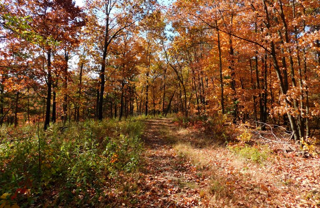
Yeah, mainly I’m talking about the fall color change. It’s simply amazing. Even though you know it’ll happen, you’ll still be speechless when you look out at a landscape that for months had been all the shades of green . . . and you suddenly realize it’s glowing yellow instead.

The whole world is yellow and orange. It’s glowing.

It doesn’t last long.

It’s that sweet transition time between “much too hot and humid; waaaay too many insects” and “freeze-your-ass-off, teeth-chattering cold; hardly anything living outside the window.” In October, you have some warm days and some cool days. Rainy and dry, windy and calm.

When you get a sunny, blue-sky day in the height of fall color, you grab it and get outside. Especially when it’s right near your birthday!

So we went hiking at Painted Rock Conservation Area, since it’ll be overcast and rainy tomorrow.

It’s one of our favorite hiking places nearby, and I’ve blogged about it before. It offers beautiful Ozark landscapes, both upland and lowland areas; a view of a serious river as well as several creeks and a few ponds.

We knew the popular, scenic Osage Bluff Scenic Trail would be busy, since it was such a gorgeous day, so we opted to hike the unnamed middle trail (that is, the other one, which is between it and the “Clubhouse Lake” trail).

This trail has a couple of designated, completely undeveloped camping places near the parking area, at around 800 feet in elevation. Then the trail leads west along a ridge for a while before splitting into a Y: the left branch continues straight west to an upland wildlife food plot (a field of crops planted for wildlife) and apparently to nothing else. Meh. . . . But the fragrant sumac along this upland part of the trail was gorgeous.

All the understory shrubs and trees were being spectacular.

Meanwhile, the right branch of the Y veers northwest, working steadily down along the north side of the east-west ridge. No switchbacks. It’s an antique road that must have been used by the original Painted Rock Country Club, pre–World War II.

You can see hints of its former development—a culvert running below the road at one point; down lower, a concrete slab as a simple bridge over a creek; and more. It tickles me to picture Model A’s putt-putting down this little road, so the mayors and governors and fat ol’ senators could get close to the river.

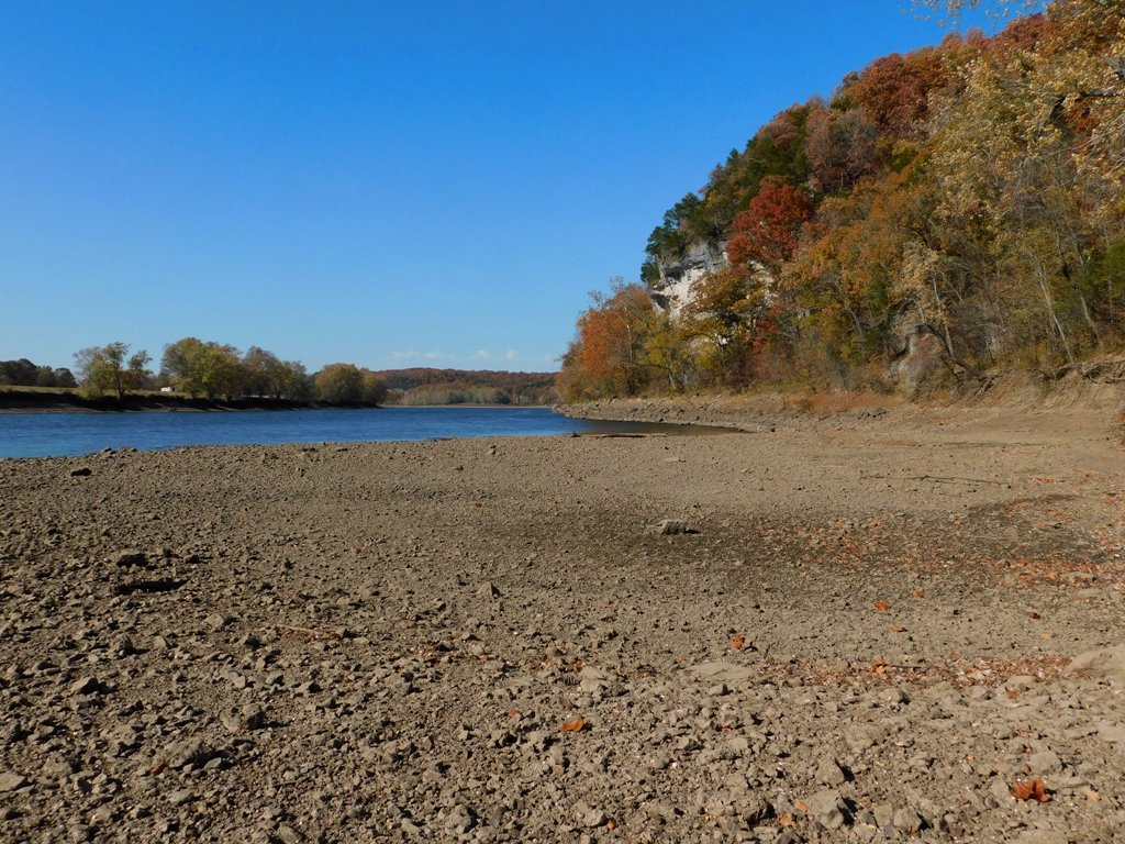
Yes, the trail ends at the Osage River, around 530 feet in elevation . . . though if we’re being honest, the trail peters out before the river. The lowland brush and brambles, fallen branches, and what-not obscure where any official trail might be. And once you beat your way to the precipice, you’re on your own to figure out how to scramble down the steep riverbank. Sometimes you can use exposed tree roots like stairsteps.

Once you’re down the bank, though, there’s a nice wide, rocky gravel bar to explore.

With the river so low, we had a lot to explore! The gravel bar was covered with dried mud; the rocks were not clean-looking as they would have been if we’d had some decent rains this late summer, even as the river levels dropped. Oh well.

Sue loves Nicola White’s videos about mudlarking in the River Thames, in London. So she pokes around looking for seventeenth-century clay pipes, Tudor money boxes, and George III ha’pennies. Naturally, she finds none of these, but she finds fun objects anyway. Old bottles, pieces of broken plates and dishes, old bones (deer bones?), rusty objects.

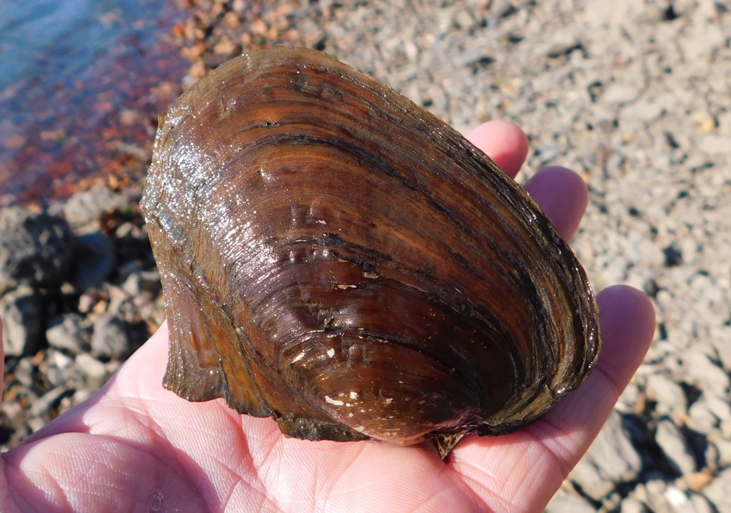
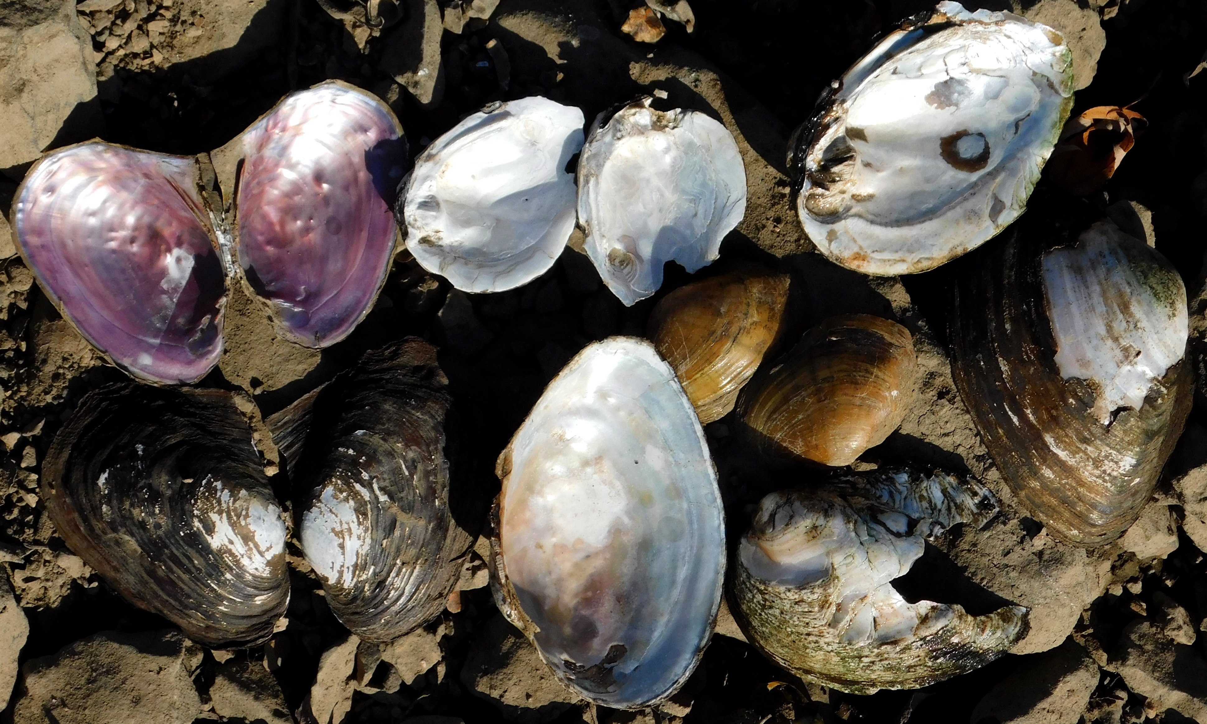
I find fun things, too. Where the bar was still muddy, hornets and some of the last butterflies of the season sought moisture. And did you know that Missouri is basically the global center of diversity for freshwater mussels, with about 70 species occurring within our borders? It’s thanks to our various, separated river systems. About 42 percent of our species are species of conservation concern, including several that are listed as threatened or endangered.

I also found a single Osage orange fruit lying partially embedded in the river mud—of the Osage River.

Who knows what curious things you’ll find when you look around.

I’m always interested in seeing the remains of the country club’s concrete steps leading down to what must have been a dock.

The old steps are gradually being erased by time and the river.

I’ll bet they had a structure here, like a fishing cottage, but I think their bona fide lodge was farther south, where their lake still exists and where you can still drive down a road to park near the river.

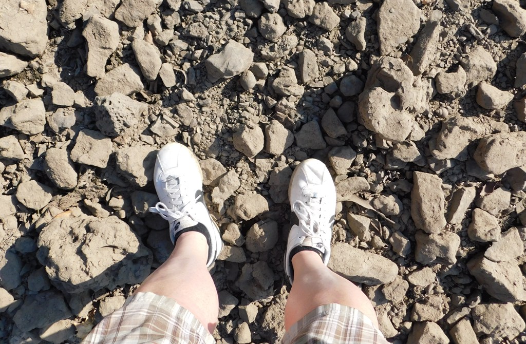
Anyway, I enjoyed taking pictures; breathing the fresh air, letting the gusty breezes flip my hair around. I even took a picture of my feet to show I was there.

It was a good day. Now it can rain for a few days, because we really need it.

I hope you’re enjoying this October, too!

Sunday, January 30, 2022

Jar of Goodness 1.30.22: The Mosses at Painted Rock CA

. . . The weekly virtual “gratitude jar.”

This week, I’m expressing thanks for the beautiful mosses and lichens at Painted Rock Conservation Area.

I’ve blogged about the place before, and here’s the official website. If you haven’t been to Painted Rock yet, you should make a point of going there for your next hike.

Wednesday, January 28, 2015

Colorful January

That sounds like an oxymoron doesn’t it! “Colorful January.” We usually think of white snow, a scene dominated by blues and cold grays, or else we think of tan, brown, gray, and more tan. At least around here, anyway.

But Sue and I have been hiking as much as we can (post-holiday fitness attempts). And we’ve been seeing things. Maybe we’re just being mighty hopeful, looking for signs of spring wherever we might find them, and imagining we see them when we don’t.

Anyway, on Saturday, we went for a nice little hike at Spring Creek Gap Conservation Area. And we did see some color!

For one thing, there’s the beautiful coppery shine of the many clumps of Virginia broomsedge, or broomsedge bluestem (Andropogon virginicus), one of our native warm-season grasses. I have always admired this plant, recognized it as being quite different from other grasses, long before I knew its name. It’s quite common, but it really shines in winter, after its bluish-green leaves have cured to a glorious copper color.


And as we hiked a little further, we started noticing there were several fallen logs with an eye-popping orange bracket fungus on them: Cinnabar polypores! These tough polypore brackets are bright orange-red above and below.


. . . As you can see.


With fungi this bright and colorful, you almost don’t miss the flowers.

In the creek, there were delicate patches of bright green filamentous algae, flowing after rocks like mermaid hair.

And here are some pretty little mosses and lichens. The tiny goblets are the reproductive structures of the lichen. Lichens, you know, are a life form that comprises both a fungus species and an algae and/or cyanobacteria species, living in a mutually beneficial relationship.


Yeah, yeah, whatever. . . . But mostly, we love them for their cute little pale blue-green fairy goblets, which contrast so nicely with the yellowish greens of the nearby moss!


As the afternoon went on, the sun drifted behind some milky white clouds. Once the golden beams disappeared, it was as if the color had been sucked out of the landscape. The sky was dull white, and it was hard to tell how close we were to sunset.

As we hiked back on the main ridge trail, the sun repaid us for its earlier shyness by dipping down below the clouds that had offended us earlier. As the sun sank below the horizon, its beams poked the bellies of the clouds, tickling them pink and orange, revealing their ripples of relief.


We just stood and took pictures!

What a great day!


Tuesday, August 20, 2013

So Many Miscellaneous Mushrooms

Hi, folks! With our nice, moist spring and this coolish summer, it has been a great year for mushrooms!

As you might remember, Sue and I enjoy going "mushroom-watching." We like to take picture of them on our hikes, even though we're not very careful about getting identifications "just right." As I explained in a previous post, we usually aren't looking for mushrooms to eat.

Nope, we're not into picking them at all, really--well, except for morels (which we can't resist)--since mushrooms are the fungus's spore-bearing structures, picking them represents a dent in their ability to reproduce. If you don't pick wildflowers because you understand wildflowers create seed, then why pick mushrooms willy-nilly? And so we photograph them.

Sue, with her nice camera, takes excellent photos at various angles, while I concentrate on getting ground-level shots and photos of the undersides, which her big camera can't do (remember, my little camera swivels so I can hold it on the ground, beneath the cap, to photograph gills and pores without disturbing the mushroom).


We recently went hiking on some of the nature trails at Columbia's Cosmos Park--near the Bear Creek Trail. I haven't been hiking out there in ages, though I used to hang out at the beaver pond there a lot during college . . .

Anyway, we decided it'd be fun to check out the place again. My, how it's changed!

And yes, there were a lot of mushrooms popping out--various species--what fun!

Here's some type of bolete we saw.


Here's a more artsy picture of the cap of another type of bolete. (If I do say so myself.) I think it might be a two-colored bolete (Boletus bicolor), but again: I'm not too anal about getting them id'd "just so." I'm content to exclaim, "Wow, look at this beautiful bolete!"


Maybe, when it comes to mushrooms, I'm just easily amused.

Here's one I'm fairly confident about identifying: It's an "old man of the woods" (Strobilomyces floccopus). There was a patch of them at one place along the trail. They were kind of camouflaged against the dirt and leaf litter, but once we saw a few of them, they seemed to be all over (in that area).


This was the first time I'd ever seen this type of mushroom "in person." I've seen pictures of them and thought, "That's a cool-looking thing. Wonder if I'll ever seen one." And there they were!

Since they are usually out in July, August, September, and October, I guess it's not surprising I haven't seen them--midsummer, with the skeeters, other bugs, and humidity, isn't my favorite time for hiking in Missouri. But with the unusual cool weather, we got outside and made discoveries!

Well, these few pictures are just a small sample of what we saw, which was itself just a small sample of all that's out there right now. I mean . . . we weren't even looking for them.


If you're interested in mushrooms and want to get more regular updates on what fungi are popping out here in Central Missouri, check out Lisa K. Suits's blog, Mycologista. She takes lovely photos of mushrooms, and she goes the extra mile to identify them correctly. As she says, she's "crazy for wild mushrooms." But if you ever thought mushrooms were boring, you should scroll through her posts for an attitude adjustment.

It's funny how you can go into the woods, say, with binoculars and a bird guide, and plan on seeing a bunch of birds; or you bring old sneakers, a few nets, and containers and a magnifying lens for looking at aquatic invertebrates--but you end up having a "mushroom trip" instead. Or maybe it's the butterflies that are somehow everywhere that day, or daisies. Nature outings, "field trips," can be like that.

. . . And it's always fun!

Thursday, August 8, 2013

Remembering Clair Kucera, His Grasses, His Gayfeathers


Sue and I drove to Tucker Prairie, just west of the Kingdom City exit off I-70 on Sunday, July 28, and spent the afternoon wandering around in that plot of never-broken prairie soil, examining plants, watching insects, and enjoying the abrupt, intense flights of an eastern kingbird. At one point, a covey of northern bobwhites erupted before us and flew away. Prairie cicadas droned . . .


I always find myself filled with wonder on a prairie. From a distance, it looks scruffy, and up close, you see that it’s a dizzying variety of plants that gives it that texture. The insects, birds, and other wildlife are similarly diverse.


Hardly any of it lives in forests, or subdivisions, or weedy roadsides. As you wade into the grasses, every few steps there is something to peer at, some new marvel.


I felt a different kind of wonder a few days later, when I learned that Dr. Clair Kucera, the ecologist credited for saving this spot of virgin prairie, had passed away the day before our visit. I felt sorrow of course, for I count him as a friend . . . but I felt wonder, too.


I heard Clair Kucera’s name a lot when I was growing up. Because I was young, I didn’t know who he was—someone my dad knew. He was a colleague of my dad’s at the University of Missouri, and they both were doing research on prairies; they were also both active in the Missouri Prairie Foundation. My dad, as I said in an earlier post, is a professional geographer who, using thousands of historical survey records as data points, mapped the presettlement prairie of Missouri.

Among Clair’s trailblazing contributions are his studies on the role of fire in maintaining prairie as prairie. He was an ecologist at a time when ecology was flowering as a discipline, and the ideas of biological succession and climax communities are core ecological concepts.

A vexing question about prairies was, What keeps them from being colonized by trees, and eventually turning into forest? We know that forests—oak-hickory being the predominant type around here—are the climax community, not tallgrass prairie.

As we know today, it was fire—started by random lightning strikes, or started by Native Americans—that kept the trees from taking over, maintaining the prairie as prairie.


Clair did much of his research at Tucker Prairie, using controlled burns, to figure out what frequencies of burning, in what times of year, are best for the prairie. How often, and when, should prairies burn, in order to keep out trees and shrubs, or kill off invasive plants like fescue, or invigorate the tallgrasses, or enhance the diversity of wildflowers and other forbs? As you can guess, these questions are critical for wise management of what few prairies remain in North America.

I don’t need to go into his life story or professional accomplishments. The Columbia Missourian did a nice job of describing those things in his obituary.

But I wanted to share a little about how I think about him. In 1995, I was living in Montana and looking for a new publishing job. When I learned of an opening here in my home state, at the University of Missouri Press, I applied for a number of reasons, but I wasn’t sure it would be a good “fit”—looking at their catalog, I noted that they published a lot of political philosophy and postmodern lit crit, which I didn’t think would interest me much. As an editor, I specialize in biology and natural history. During a phone interview, I asked if the press ever published much of that kind of stuff.


When the managing editor, who was speaking with me, mentioned that Clair Kucera’s manual The Grasses of Missouri would be coming out in a revised edition in the next few years, and I might get to work on it, my opinion of the job prospect improved tremendously. The first edition had been published in 1961, and this would be not only a chance to work in my preferred area, but also an opportunity to work with someone I had long admired.

And it was a pleasure and an honor to work with him. Even after the book came out, he sometimes called me just to chat. One time, he brought me some Liatris pycnostachya corms—surplus gayfeathers from his farm—to plant at the apartment where I lived then. So naturally, whenever I see blazing stars, I think of him.


And, of course, I think of him whenever I see prairie grasses, too. He wrote the book on them.


One more thing. Next time you’re on I-70 heading east out of Columbia, not long before the Kingdom City exit, turn your head and look at the scrubby-looking green grassland to the south. There’s a sign that says “Tucker Prairie,” in case you’re not sure.


The humble green building there is the Clair Kucera Research Station. Since the last time I wrote about Tucker Prairie, it’s been repainted and the windows repaired. It may not look like much, but for ecologists, for lovers of the prairie, and for friends of Clair Kucera, this research station, and this 160 acres, is cherished ground.

Sunday, April 10, 2011

The Pedestrian Bridge Is Open!

Friday morning was the ribbon-cutting ceremony and the official first crossing of the new pedestrian lane on the Missouri River Bridge!


I told you about the groundbreaking ceremony for this project last May. Click here for some scary "before" photos!

The new section is attached by enormous brackets to the eastern edge of the northbound bridge.


This nice, wide path is a huge improvement on how it used to be, when walkers and bicyclists had only a few feet of thin air between themselves and the 50,000 cars and trucks that blast over the river each day.


Not to mention that bicyclists attempting to ride south to reach Jeff City were forced to ride on the left, against traffic, which is kind of suicidal, plus it's ingrained into us all as illegal. Most Katy Trail bicyclists, I suspect, simply opted to stop at Hartsburg instead, with an attitude about Jeff having "nothing worth risking your life to see."

To access the bridge from the south (Jefferson City), park near the intersection of West Main and Clay streets—that’s where the pathway begins, behind bright yellow posts.


Round the curve, and soon you'll be on the bridge.


There is a special section with higher fences over the train tracks; I think it's to prevent the slower among us from throwing objects down on the rails.


The path gives you excellent views of Jefferson City and the state capitol. There are two places over the river where the path widens, where you can pause to enjoy the view.


You can take great photographs from the bridge!


Then, once you’re over the river, a big ramp, shaped like a square spiral, leads you down comfortable grades to the river bottom, near the Noren River Access. From there, a short ride leads to the “North Jefferson City” access point of Katy Trail State Park.


The Katy Trail, I should mention, is the longest rails-to-trails pathway in the United States; at the present, it extends from St. Charles in the east to the city of Clinton in the west; much of it includes incredibly scenic stretches through Missouri’s wine country and between tall limestone cliffs on one side and the beautiful Missouri River on the other.

Although initially it was controversial, especially among landowners who believed the trail would deliver riffraff and trash onto their rural properties, the Katy Trail has proved enormously helpful to many small communities that had seen nothing but “bust” since the decline of the railroads. Now, the Katy Trail brings cyclists (such as me), hikers, big-city residents with disposable income, and family day-trippers to these small towns, and they’re interested in dining, shopping, spending the night at B&Bs, and getting a taste of the “local color.”

Towns such as Boonville, Rocheport, Hartsburg, Hermann, and Sedalia are called “Katy Trail Towns,” and now that Jeff City is officially connected, it becomes a Katy Trail Town, too!

I can’t wait until my ankle’s all better, so I can start riding my bike across! (That ramp looks like a lot of fun!)


One more thing: Although the local and state officials who spoke at the ceremony had lots of thanking to do--and I won't repeat it here, for there were many individuals and businesses who donated to this project (look for their names on pavers and a plaque at the south end of the bridge)--I want to express my appreciation, respect, and admiration for the workers who risked life and limb while constructing the pedestrian bridge. Here are some of them.


Folks, they were out there on the edge of the bridge in the freezing cold, with cars whooshing right past them at ninety miles per hour (in a sixty mph zone), and working high over the river; there were dozens of ways to die out there. And it was a record-snowfall winter, yet they finished on time and on budget. Great work, fellows! I will think of you each time I use the bridge!

Thanks, Sue, for taking such awesome pictures!