Showing posts with label Painted Rock CA. Show all posts

Sunday, October 23, 2022

Jar of Goodness 10.23.22: October Day at Painted Rock

. . . The weekly virtual “gratitude jar.”

This week, I’m expressing thanks for today’s trip to Painted Rock Conservation Area.

Yeah, mainly I’m talking about the fall color change. It’s simply amazing. Even though you know it’ll happen, you’ll still be speechless when you look out at a landscape that for months had been all the shades of green . . . and you suddenly realize it’s glowing yellow instead.

The whole world is yellow and orange. It’s glowing.

It doesn’t last long.

It’s that sweet transition time between “much too hot and humid; waaaay too many insects” and “freeze-your-ass-off, teeth-chattering cold; hardly anything living outside the window.” In October, you have some warm days and some cool days. Rainy and dry, windy and calm.

When you get a sunny, blue-sky day in the height of fall color, you grab it and get outside. Especially when it’s right near your birthday!

So we went hiking at Painted Rock Conservation Area, since it’ll be overcast and rainy tomorrow.

It’s one of our favorite hiking places nearby, and I’ve blogged about it before. It offers beautiful Ozark landscapes, both upland and lowland areas; a view of a serious river as well as several creeks and a few ponds.

We knew the popular, scenic Osage Bluff Scenic Trail would be busy, since it was such a gorgeous day, so we opted to hike the unnamed middle trail (that is, the other one, which is between it and the “Clubhouse Lake” trail).
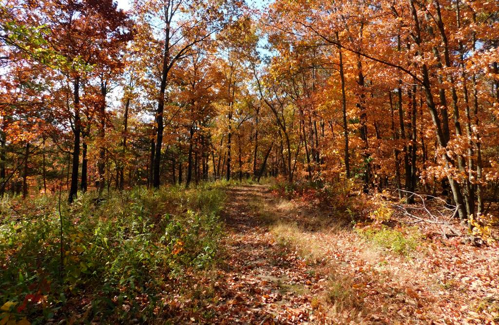
This trail has a couple of designated, completely undeveloped camping places near the parking area, at around 800 feet in elevation. Then the trail leads west along a ridge for a while before splitting into a Y: the left branch continues straight west to an upland wildlife food plot (a field of crops planted for wildlife) and apparently to nothing else. Meh. . . . But the fragrant sumac along this upland part of the trail was gorgeous.

All the understory shrubs and trees were being spectacular.

Meanwhile, the right branch of the Y veers northwest, working steadily down along the north side of the east-west ridge. No switchbacks. It’s an antique road that must have been used by the original Painted Rock Country Club, pre–World War II.

You can see hints of its former development—a culvert running below the road at one point; down lower, a concrete slab as a simple bridge over a creek; and more. It tickles me to picture Model A’s putt-putting down this little road, so the mayors and governors and fat ol’ senators could get close to the river.

Yes, the trail ends at the Osage River, around 530 feet in elevation . . . though if we’re being honest, the trail peters out before the river. The lowland brush and brambles, fallen branches, and what-not obscure where any official trail might be. And once you beat your way to the precipice, you’re on your own to figure out how to scramble down the steep riverbank. Sometimes you can use exposed tree roots like stairsteps.

Once you’re down the bank, though, there’s a nice wide, rocky gravel bar to explore.

With the river so low, we had a lot to explore! The gravel bar was covered with dried mud; the rocks were not clean-looking as they would have been if we’d had some decent rains this late summer, even as the river levels dropped. Oh well.
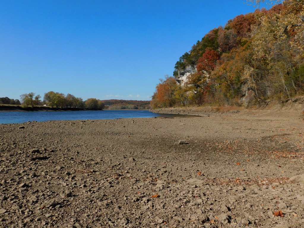
Sue loves Nicola White’s videos about mudlarking in the River Thames, in London. So she pokes around looking for seventeenth-century clay pipes, Tudor money boxes, and George III ha’pennies. Naturally, she finds none of these, but she finds fun objects anyway. Old bottles, pieces of broken plates and dishes, old bones (deer bones?), rusty objects.

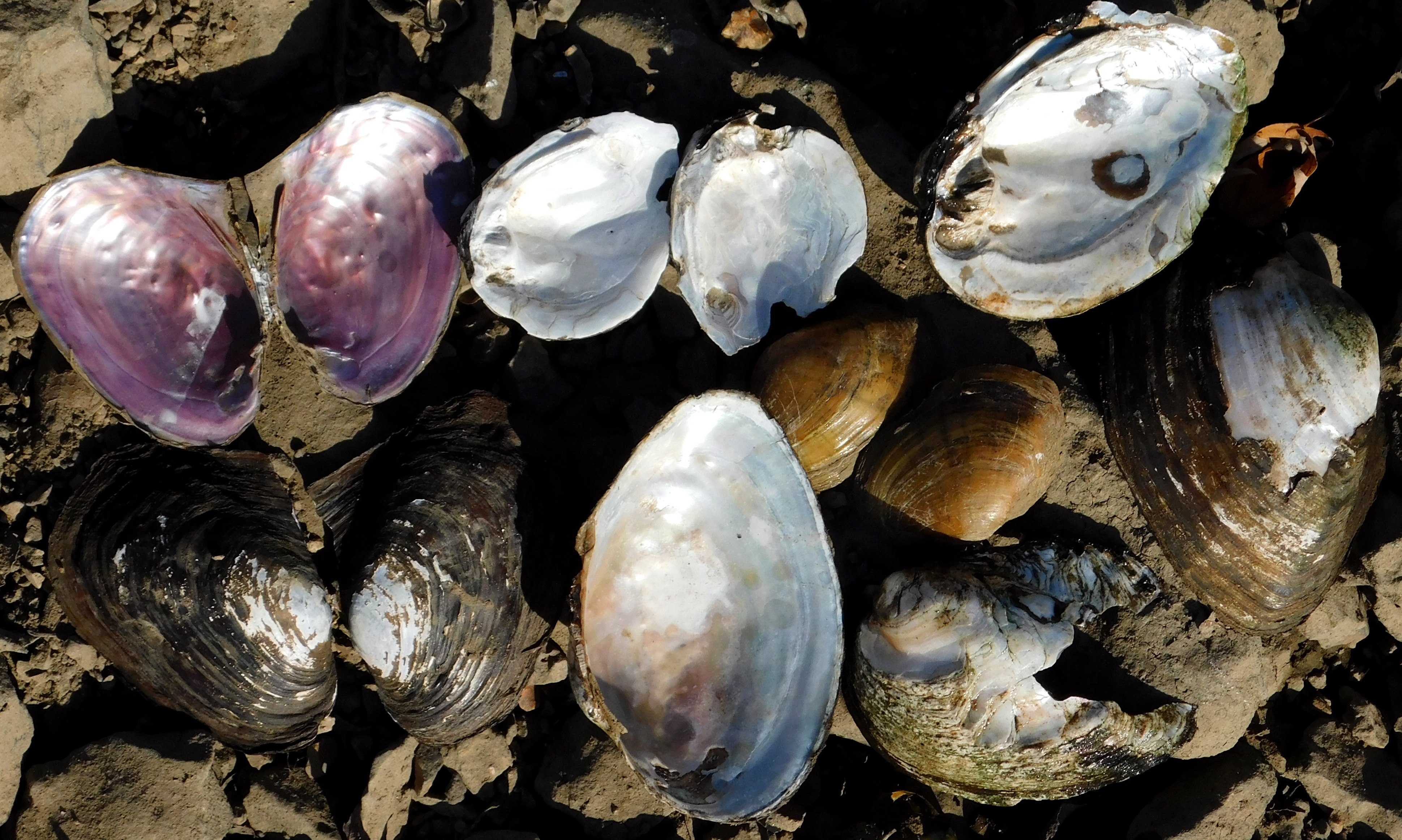
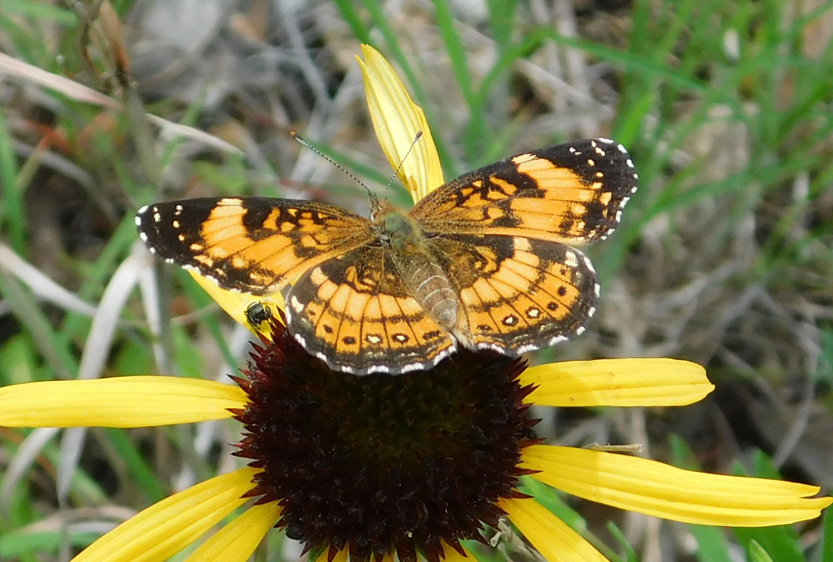
I find fun things, too. Where the bar was still muddy, hornets and some of the last butterflies of the season sought moisture. And did you know that Missouri is basically the global center of diversity for freshwater mussels, with about 70 species occurring within our borders? It’s thanks to our various, separated river systems. About 42 percent of our species are species of conservation concern, including several that are listed as threatened or endangered.
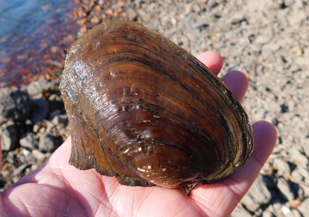
I also found a single Osage orange fruit lying partially embedded in the river mud—of the Osage River.

Who knows what curious things you’ll find when you look around.

I’m always interested in seeing the remains of the country club’s concrete steps leading down to what must have been a dock.

The old steps are gradually being erased by time and the river.

I’ll bet they had a structure here, like a fishing cottage, but I think their bona fide lodge was farther south, where their lake still exists and where you can still drive down a road to park near the river.

Anyway, I enjoyed taking pictures; breathing the fresh air, letting the gusty breezes flip my hair around. I even took a picture of my feet to show I was there.
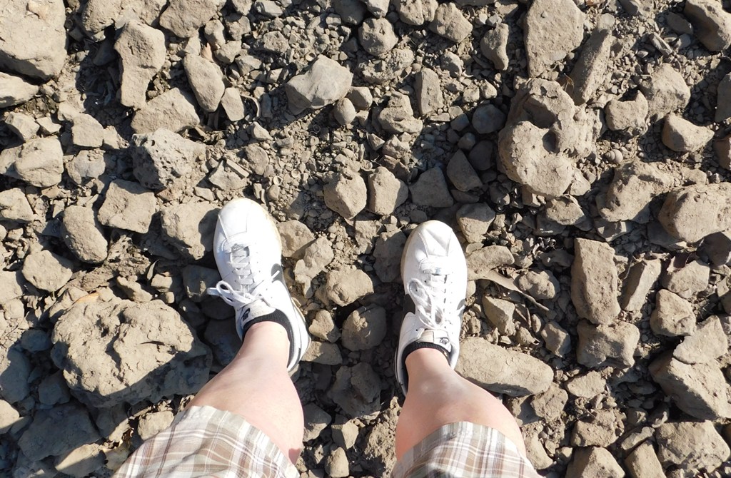
It was a good day. Now it can rain for a few days, because we really need it.

I hope you’re enjoying this October, too!

Sunday, June 5, 2022

Jar of Goodness 6.5.22: Butterflies of June

. . . The weekly virtual “gratitude jar.”

This week, I’m expressing thanks for the butterflies of June.

Really, anyplace flowers are blooming, this time of year, you’ll see butterflies. But today we saw them at Painted Rock Conservation Area; along the drive to the main parking lot, there’s a glade vegetation planting with lots of coneflowers, butterfly weed, and more.

So here are some pictures of a silvery checkerspot and great spangled fritillary. There were many, both butterflies and flowers.

And it just felt magical.

Sunday, January 30, 2022

Jar of Goodness 1.30.22: The Mosses at Painted Rock CA

. . . The weekly virtual “gratitude jar.”

This week, I’m expressing thanks for the beautiful mosses and lichens at Painted Rock Conservation Area.

I’ve blogged about the place before, and here’s the official website. If you haven’t been to Painted Rock yet, you should make a point of going there for your next hike.

Friday, August 31, 2012

Not-So-Opulent Armadillos


They still seem like newcomers, and why shouldn’t they? Here in Central Missouri, we never “see” them—unless you count their poor bodies lying lifeless—like overturned baskets—on the roadsides.

Poor critters . . . cars are so rude.


And to people north of the Missouri River, they truly are newcomers; the river serves as a serious barrier to their northward expansion. Each time a few of them manage to get across the river here and there, and begin new population centers, a hard winter eradicates them from the whole region. Or, that’s what people have thought.

Armadillos are insectivores, and they don’t hibernate. A hard winter that freezes the ground and prevents them from getting to delicious, hibernating insects wipes them out. It hits the “restart” button, and when that happens, Missouri has few, if any, armadillos until immigrants of that species, expanding from firm populations south of us, replenish the species in our state.

In 1959, when Charles and Elizabeth Schwartz published the first edition of The Wild Mammals of Missouri (a book I could not live without), armadillos were not known to live in our state. By the time they first revised the book, in 1981, the Schwartzes listed the armadillo as “possibly occurring.” By 2001, when Elizabeth Schwartz presented to our state the second revised edition—an endlessly fascinating guidebook, textbook, encyclopedia, and lavishly, perfectly illustrated volume—armadillos had definitely become established as “full residents,” “having been collected in 66 counties.”


So the armadillo is no longer just the “state bird of Texas”!

Dr. Lynn Robbins and his students at Missouri State University have for decades studied the range expansion of these curious critters, which so many of us still equate with the Longhorn State, and not the Show-Me State. Here’s a request for citizens to help with their studies; this appeared in the March 1993 issue of the Missouri Conservationist (the official monthly publication of the Missouri Department of Conservation):


So Why Am I Writing about Armadillos Today?

Well, Sue and I have been hiking recently at Painted Rock Conservation Area, south of Jefferson City along the Osage River where it bends (at Osage Bend), and we were astonished to see several armadillos abroad in daylight. It was midafternoon, and they were wandering around in the leaf litter, in the oak-hickory forest, foraging constantly.


What does a foraging armadillo look like? Nose-to-ground! Their conical heads poke through the leaf litter, snout-first, and the rest of the body follows. They plow through the fallen leaves in a random zigzag path, leaving a rounded tunnel behind. The leaves atop the “tunnel,” parted by the body, fall back together somewhat, but you can see through them to the ’dillo trail.


Armadillos specialize in eating insects (though they opportunistically eat other little critters, as well). They whiffle along the ground, snuffling for grubs, beetles, ants, and whatever else. They dig into the earth as far as six inches to locate a juicy insect their noses have detected.

It’s really interesting to watch them. They have terrible vision and next-to-terrible hearing, so they tend not to notice if they’re being observed. I think the constant crunching of dry leaves around their heads drowns out the sound of voices and footsteps.

Apparently, armadillos have been remarkably active this summer in general. One of my friends thinks it’s armadillos that have been rooting up her garden over at Osage Bluff.


They’re supposed to be mostly nocturnal during the summer—so why are they out in daylight?

It appears to be environmental: Remember last winter, when it never really got to be truly “winter”? Presumably a large number of armadillos survived Missouri’s winter last year. During our usual cold, freezing winters, many of them simply perish. Even in good years, they don’t put on much body fat to shiver away to stay alive—and any mammal that doesn’t hibernate has to “stoke the fires” of life in freezing weather by “eating hearty.” Frozen ground is not conducive to digging. So many ’dillos die.

But it was hardly even cold last winter, so we probably had record numbers of armadillos survive until springtime. Then we had a nice wet spring (remember?) and plenty of insects had survived the mild winter, too. Things were looking up for the armadillos at that point—but then the drought set in.


I suppose the drought is doing to the armadillos what winter failed to do—limit the populations. By the end of August, insects have become hard to find, and so has water. The armadillos are close to starving—and that’s why they’re out during the day, even, hunting relentlessly for bugs, grubs, beetles, weevils, pupae, lizards, darn near anything, to eat.


I recently contacted Dr. Robbins with my hypothesis, and responding in an e-mail of August 27, 2012, he said he thinks I’m on the right track. He mentioned, however, that many armadillos do seem to be surviving our midwestern winters—somehow, decent numbers of them manage to find shelter and food, so the idea of them all perishing with cold weather is not as strict as once supposed. That they’ve been continuously present in Nebraska for fifteen years, he says, “leads me to believe that even if a high percentage do not make it through a winter, they do find refuges where they can find enough food to make it.” They don’t seem to “fatten up” before winter, but they seem to survive anyway, by finding “large amounts of food under the leaf litter and by digging in unfrozen ground.”

Regarding what we saw at Painted Rock, and the drought, Dr. Robbins noted, “If the drought continues, I too will be concerned, and the conditions you observed are similar to the way they [the armadillos] looked after the [recent] big snow event, including their frantic behavior to catch up. I have been seeing increasing numbers of road kills north of the Missouri River this summer.” He continued, “if there is a reduction in food as a carryover from this drought, it could be a problem.”

(Thank you, Dr. Robbins, for helping me understand this interesting animal, and for your work in helping humanity to understand many kinds of mammals, too!)

So there you have it—although Sue and I were thrilled to see our first ever—living—armadillos, the situation wasn’t optimal for all parties. I hate the thought of anything suffering. Let’s hope the rain is bringing them some relief.


Bonus info! The scientific name for the nine-banded armadillo is Dasypus novemcinctus. Dasypus is the genus name for our armadillo and is used for six other closely related (living) armadillo species as well. (Dasypodidae is the name for the whole armadillo family, which comprises about 21 species, in various genera.) Dasypus means “rough-footed.” Since armadillos are diggers by trade, they have coarse, sturdy feet!

The only species of armadillo found in the United States is the nine-banded armadillo, Dasypus novemcinctus. The second half of the name means “nine-banded” (“novem-” for “nine,” and “-cinctus” for “belted”—as in “cincture,” an encircling belt, or to “cinch” up something).

SPECIAL THANK YOU to Susan Ferber, who took all the great photos in this post and has graciously allowed me to use them on my blog. Not only is she a talented and skilled photographer, but also: She is the best person in the world to go hiking with!

Sunday, November 15, 2009

Walking Stick


Another one of my little friends, Diapheromera femorata, the northern walking stick. This little fella crept quietly onto my leg when we were at Painted Rock last weekend; I was crouching in the leaf litter, trying to photograph a pretty orange mushroom.

. . . What a cool bug, huh?

Painted Rock Conservation Area


Painted Rock has been a favorite getaway for Jefferson Citians for generations. It’s just far enough away to keep it special, to make it a destination instead of a place to hang out by default.

This is another of those public lands that offer a variety of features, macro and micro, in both natural and human history. Comprising 1,480 acres, it’s a substantial area that can be visited repeatedly and continually yield surprises.

Where is it? Painted Rock CA is along the Osage River south of Jefferson City, southwest of the tiny town of Folk, off of Highway 133 between Meta and Westphalia. It’s about seven miles southwest of the junction of Highways 63 and 133. (That’s a pretty loop drive, by the way, between Westphalia and Meta, and then back to Jeff City through St. Thomas. I’m just sayin’.)

Human History

The Missouri Department of Conservation acquired the land in 1981, but it’s been used as a park and preserve since the last quarter of the 1800s. At that time, the land was leased and used by a group of affluent citizens of Jefferson City for hunting purposes. In 1907, when the land appeared to be in danger of being subdivided and sold, the group of hunters organized formally into the Painted Rock Country Club and purchased the property—1,086 acres.

The country club, whose members included Governor Herbert Hadley, had a clubhouse on the land, gathered there on the weekends, and had fall and winter hunts for deer, turkey, squirrels, rabbits, quail . . . this at a time when game was becoming increasingly scarce in the state due to the lack of centrally organized conservation efforts.

Again, these were prominent people; in 1909 the group’s annual banquet was held at the Governor’s Mansion, and it’s widely agreed that this club’s members were instrumental in developing and supporting Missouri’s first statewide hunting laws as well as creating (in 1936) the state’s department of Conservation.

The club’s heyday was in the 1920s, but it declined somewhat during the Depression; the land was sold in the mid-1940s and then sold again in 1952 to Sam B. Cook, a prominent Jefferson City banker who was the son and grandson of men who had been members of the country club. In 1981 he sold the property to the Missouri Department of Conservation, which developed the trail overlooks, interpretive signs, and other information, and worked to improve the quality of the area’s oak-hickory forests.


But the human history of the area goes back much farther than the country club. In fact, one of the first points on the interpretive trail is an Indian burial cairn (sadly vandalized long ago, so apparently there’s no good way to be sure of its age, or much else).


Also, there is the feature that gives the area its name: red pictographs of a buffalo and other symbols painted high on bluffs overlooking the Osage River by Indians between A.D. 1200 and 1300. For decades, the “Painted Rock” was a landmark for explorers, traders, and others who navigated the Osage, including Zebulon Pike, who noted it in 1806.

We tend to forget how very important rivers used to be in trade and transportation. The reason the state capital is at its current location is because the state’s early leaders specified that it had to be on the Missouri River, within forty miles of the mouth of the Osage.

I’ve never seen the “Painted Rock” pictographs; I don’t know where they are. The MDC literature for the Osage Bluff trail states they are “not accessible by the trail.” You can see recent images of them here. Apparently they are growing fainter and disappearing as the rocks weather; some disappearing in the last two hundred years.

I’d love to see the pictographs someday, whether from a boat or on foot. But for now, for me, the name “Painted Rock” can refer symbolically to the lovely splotches of mosses and lichens painting the many stones and outcroppings along the trail. This area must be home to dozens of species of bryophytes and their miniature amigos, crustose, foliose, and fruticose.


Hiking

There is much to enjoy on the 1.6 mile Osage Bluff Scenic Trail, a loop that begins at a nice gravel parking lot and leads through pleasant forested territory before reaching tall bluffs and a nifty observation deck overlooking the Osage River, with a view of Bloody Island (which has its own colorful lore).


The trail then skirts the river, gradually descending to its lowest elevational point (a footbridge that crosses Cove Creek), then ascends a cool, fern-covered, north-facing hillside to emerge on another observation deck overlooking the Osage. Then, it’s another fairly level hike through oak-hickory woods back to where you parked.


There are some fairly steep sections of the trail, but these have long, mild switchbacks that make the grades less strenuous. Another issue for some hikers could be the rockiness at some places; yes, this is the Ozarks, and rocks are forever poking out of the soil. You know. “Ozark potatoes.” So flip-flops and penny loafers just aren’t a good idea. If you have Leki poles, you might be glad you brought them.


More Things to See

Probably the most remarkable things about Painted Rock are the breathtaking views of the Osage River from along high bluffs. The southern viewing platform is 140 feet over the river, and you have a tremendous view of the Osage Bend (yes, which the town of Osage Bend is named for; that burg lies across the river, within the river’s big loop). You can see flat cropland and farmhouses, and gentle distant hills that, the interpretive brochure points out, would have become steep Osage bluffs if the river had flowed to the west instead of its current course.

Also at the southern overlook, there’s an eastern red cedar clinging to the bluff that is approximately six hundred years old. It’s not very large. Sue, the bonsai artist, always admires it—and many other cedars on these bluff—for their strong, twisted shapes and tremendous character.


I should mention that there are a number of wooden benches at different points overlooking the Osage. We usually like to bring an apple to gnaw on while we enjoy the view. These overlooks are fantastic places to see sunsets, I might add.


Along the bluffs overlooking the river is also a good place to look for soaring birds, ranging from turkey vultures to bald eagles, as well as great blue herons and others associated with large rivers.

Another thing to enjoy at Painted Rock are the unpainted rocks—I mean, the basic geology of the area. The Gasconade Formation rocks that poke out in places were deposited as ocean sediments over 400 million years ago. There’s lots of sandstone, chert, and dolomite about, much of it eye-catching as you walk.


There’s a point, about midway in the trail when you’re getting close to river level, where you pass a remarkable shelf of dolomite and chert—which is a cool grayish-purple—there’s nothing under it, as a softer, tannish dolomite layer beneath it has eroded away.


Atop the shelf layer is an icing of sandstone, which sparkles when it catches the light. It’s so soft, it looks like it’s melting from the elements. There are holes, tiny caves, in it.


We always pause at this outcrop and smile as we fancy that this outcrop, with its decorations of various mosses, looks like a miniaturized version of the bluffs around us. It’s fun to take pictures that represent this; with a little imagination (or confusion), you might think you’re looking at a long-distance view of the bluffs, or a side of a mountain.


I really like to go hiking where I can be delighted by both small things and expansive things, and if you’re like me, you’ll enjoy Painted Rock Conservation Area, too.


Sources

“History of Painted Rock Country Club Tied to Development of a State Conservation Program,” in Gary R. Kremer, Heartland History Volume 3 (Jefferson City, Mo.: City of Jefferson, 2004), 28-31. (This essay includes some neat pictures of the country club's parties and outings.)

Osage Bluff Scenic Trail: Painted Rock Conservation Area, trail brochure published by the Missouri Department of Conservation (n.d.), available at the trailhead.