Showing posts with label Osage River. Show all posts

Sunday, October 23, 2022

Jar of Goodness 10.23.22: October Day at Painted Rock

. . . The weekly virtual “gratitude jar.”

This week, I’m expressing thanks for today’s trip to Painted Rock Conservation Area.

Yeah, mainly I’m talking about the fall color change. It’s simply amazing. Even though you know it’ll happen, you’ll still be speechless when you look out at a landscape that for months had been all the shades of green . . . and you suddenly realize it’s glowing yellow instead.

The whole world is yellow and orange. It’s glowing.

It doesn’t last long.

It’s that sweet transition time between “much too hot and humid; waaaay too many insects” and “freeze-your-ass-off, teeth-chattering cold; hardly anything living outside the window.” In October, you have some warm days and some cool days. Rainy and dry, windy and calm.

When you get a sunny, blue-sky day in the height of fall color, you grab it and get outside. Especially when it’s right near your birthday!

So we went hiking at Painted Rock Conservation Area, since it’ll be overcast and rainy tomorrow.

It’s one of our favorite hiking places nearby, and I’ve blogged about it before. It offers beautiful Ozark landscapes, both upland and lowland areas; a view of a serious river as well as several creeks and a few ponds.

We knew the popular, scenic Osage Bluff Scenic Trail would be busy, since it was such a gorgeous day, so we opted to hike the unnamed middle trail (that is, the other one, which is between it and the “Clubhouse Lake” trail).
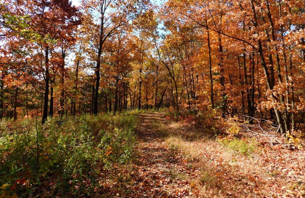
This trail has a couple of designated, completely undeveloped camping places near the parking area, at around 800 feet in elevation. Then the trail leads west along a ridge for a while before splitting into a Y: the left branch continues straight west to an upland wildlife food plot (a field of crops planted for wildlife) and apparently to nothing else. Meh. . . . But the fragrant sumac along this upland part of the trail was gorgeous.

All the understory shrubs and trees were being spectacular.

Meanwhile, the right branch of the Y veers northwest, working steadily down along the north side of the east-west ridge. No switchbacks. It’s an antique road that must have been used by the original Painted Rock Country Club, pre–World War II.

You can see hints of its former development—a culvert running below the road at one point; down lower, a concrete slab as a simple bridge over a creek; and more. It tickles me to picture Model A’s putt-putting down this little road, so the mayors and governors and fat ol’ senators could get close to the river.

Yes, the trail ends at the Osage River, around 530 feet in elevation . . . though if we’re being honest, the trail peters out before the river. The lowland brush and brambles, fallen branches, and what-not obscure where any official trail might be. And once you beat your way to the precipice, you’re on your own to figure out how to scramble down the steep riverbank. Sometimes you can use exposed tree roots like stairsteps.

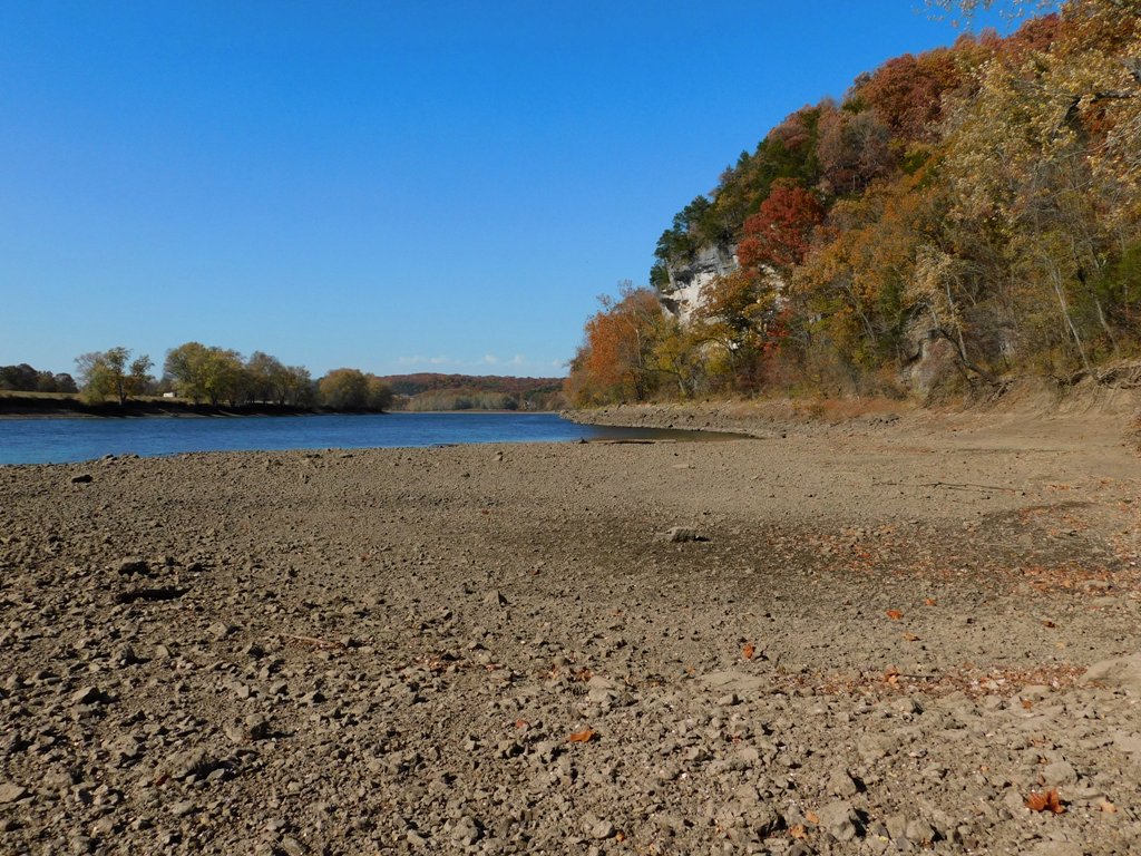
Once you’re down the bank, though, there’s a nice wide, rocky gravel bar to explore.

With the river so low, we had a lot to explore! The gravel bar was covered with dried mud; the rocks were not clean-looking as they would have been if we’d had some decent rains this late summer, even as the river levels dropped. Oh well.
Sue loves Nicola White’s videos about mudlarking in the River Thames, in London. So she pokes around looking for seventeenth-century clay pipes, Tudor money boxes, and George III ha’pennies. Naturally, she finds none of these, but she finds fun objects anyway. Old bottles, pieces of broken plates and dishes, old bones (deer bones?), rusty objects.

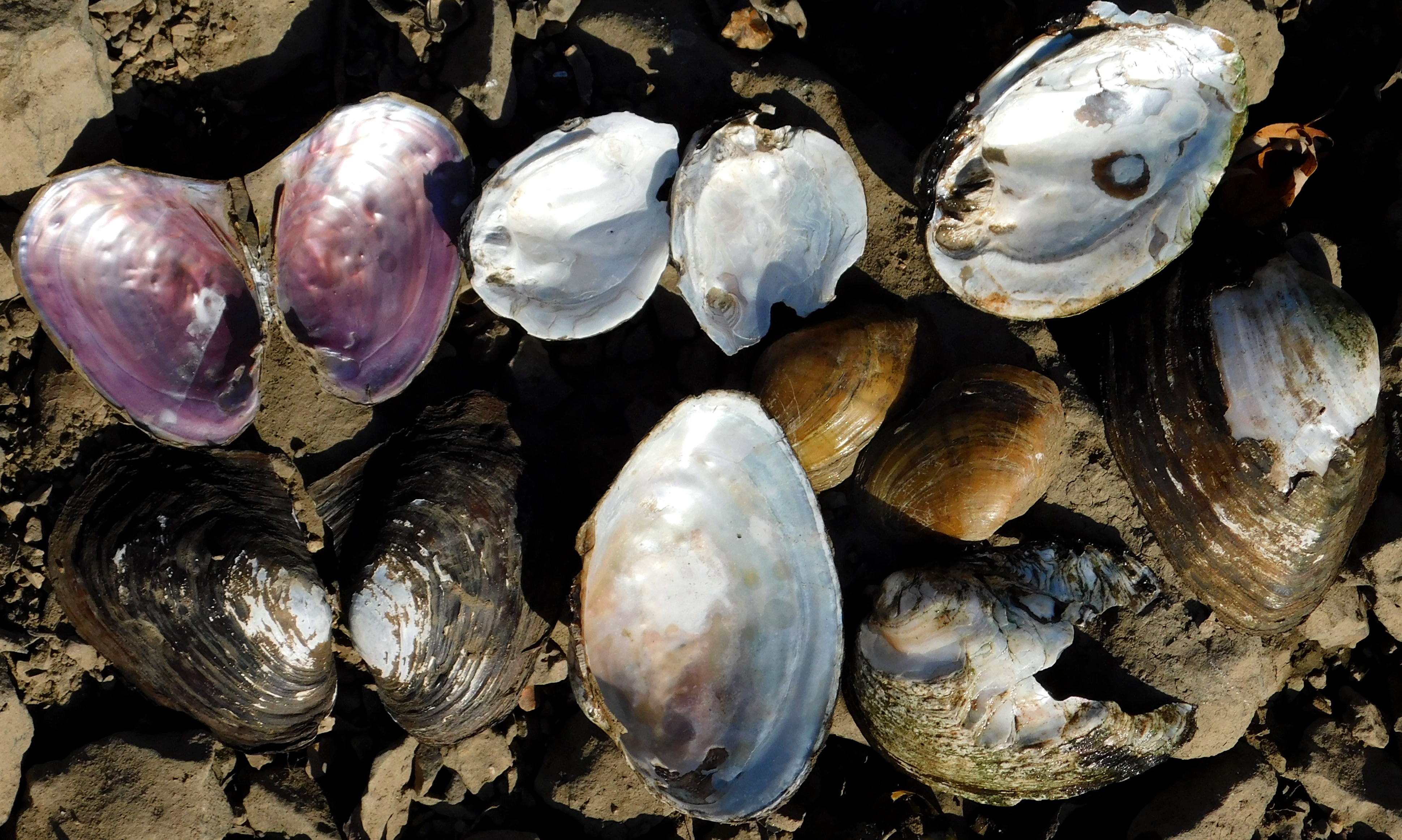
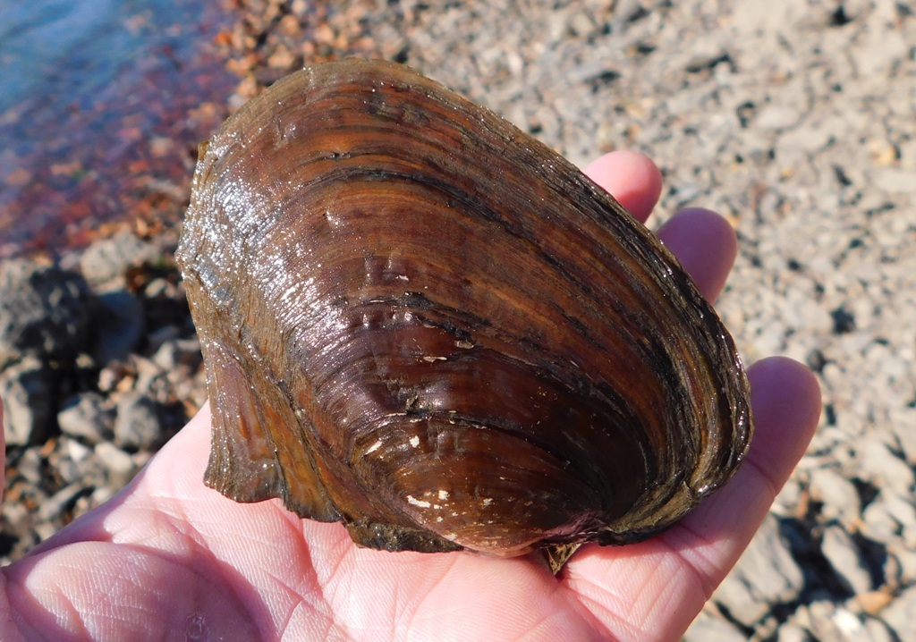
I find fun things, too. Where the bar was still muddy, hornets and some of the last butterflies of the season sought moisture. And did you know that Missouri is basically the global center of diversity for freshwater mussels, with about 70 species occurring within our borders? It’s thanks to our various, separated river systems. About 42 percent of our species are species of conservation concern, including several that are listed as threatened or endangered.
I also found a single Osage orange fruit lying partially embedded in the river mud—of the Osage River.

Who knows what curious things you’ll find when you look around.

I’m always interested in seeing the remains of the country club’s concrete steps leading down to what must have been a dock.

The old steps are gradually being erased by time and the river.

I’ll bet they had a structure here, like a fishing cottage, but I think their bona fide lodge was farther south, where their lake still exists and where you can still drive down a road to park near the river.

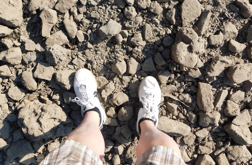
Anyway, I enjoyed taking pictures; breathing the fresh air, letting the gusty breezes flip my hair around. I even took a picture of my feet to show I was there.
It was a good day. Now it can rain for a few days, because we really need it.

I hope you’re enjoying this October, too!

Sunday, October 16, 2011

Where the Heck Have I Been?

I’ve been busy—yeah, I know, lame excuse! Bad blogger! But as you know, this is the best time of year to be in the Midwest, and alive, and I’ve been trying to soak it all in. This post is my list of excuses for not having blogged for a while.

The fall colors this year haven’t been especially spectacular, but the flowers (asters, chrysanthemums, etc.) have been doing well, and the trees have been doing their best, even though it was just too dry for them this summer and fall.

I don’t talk much about my work life on this blog, but this is kind of cool: One of my current freelance activities involves the Missouri Department of Conservation’s “Fall Color” website, where you can view weekly reports on the progress of autumn from foresters representing all of Missouri’s regions.

And yeah, apart from the dryness, the temperatures have been great, with the clear blue skies and dry air so perfect for hiking, and cool evenings that are optimal for sleeping.

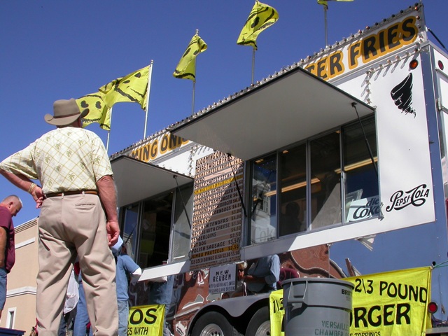
On October 1, we visited, for the first time, the town of Versailles’s “Old Tyme Apple Fest,” billed as the state’s largest one-day festival. And it was very fun, with perfect weather. Good music! Lots of craft and food vendors!


Versailles, Missouri, as you know, is pronounced vurr-SAY-ullz. It’s the seat of Morgan County and became famous as an apple-growing area. (Remember when we talked about Jacob’s Cave, also in Morgan County? At one time, it was used as a cool storage place for the region’s apples!) Today, the town is more famous as a northern gateway to the Lake of the Ozarks.

I was certainly expecting to see more “Old Tyme Apple stuff” than I did, but there were a few vendors selling caramel apples, and the Lions had an antique steam-powered apple squisher and press and were selling apple cider, and that was great!


I was terribly impressed by one food vendor from Iowa, the “Corn Roasting Company.” They had a big yellow corn roaster and were selling ears of roasted corn—with the husks pulled back into a “handle”—with your choice of Mexican, Cajun, or “American” seasonings. They were also selling fried dill pickles, homemade jalapeno poppers (with bacon!), spicy linguiƧa sausage, and cute little single-serving-size smoky meatloafs (cooked and served in a pot-pie pan). This was totally not your average “festival food” (though there was plenty of that around, too).


We ended up “eating our way” through that festival, even though, in the interest of saving some money, we’d packed a lunch of baloney sandwiches, grapes, and potato chips.


We ended up having our “lunch” as a picnic dinner during sunset on the Osage, after a pleasant drive through Tuscumbia, St. Elizabeth, and Meta, and a hike through Painted Rock Conservation Area to the river’s edge.


. . . And then, last week, we traveled to northern Ohio—a driving trip, so we got to enjoy all the fall color between here and there. Driving north, I had expected to see the progression of autumn in a speeded-up, telescoped way, but the latitudinal gradient seemed to have little effect on the color this year. Moisture seems to have dictated the timing and intensity of color instead. In fact, it was greener in northern Ohio than it was in Missouri.


One of the fun things I’ve been up to—well, it’s fun for me—especially on car trips, is that I’ve been learning to recognize the various makes of trucks (yeah—as in semis, eighteen-wheelers, class 8 trucks). So I’ve been scrutinizing the shapes of radiators, insignia badges, and the overall designs of the vehicles.


Except to zip around them while ascending a hill, and stuff like that, I had never paid much attention to trucks before.

I started trying to learn to distinguish them on our way home from our Fourth of July trip to Ohio, and on this trip I was pleased to discover that I’ve gotten pretty darn good at telling a Kenworth from a Peterbilt from a Freightliner, and a Mack from an International. It’s kind of like learning how to identify the various species of birds.


Some are fairly rare. Western Stars, for example, are definitely a minority. They’re based in South Carolina, although, like Freightliner and Sterling, the company’s a subsidiary of Daimler.

It’s also rare, now, to see any kind of large COE—cab-over-engine configuration—on the interstates. The flat-fronted, less-aerodynamic design is out of vogue these days, except for smaller, in-town delivery trucks, where drivers appreciate having a better view for maneuvering.

International is currently making a model, the “LoneStar,” with a striking profile—its grille is heavy with chrome, V-shaped, steeply slanted, with a strongly retro/hot-rod feel. Its design was inspired by the look of 1939 International pickups. Compared to the un-aerodynamic fronts of classic, heavy-duty Peterbilts and Kenworths, this sleek truck might prove to be a pacesetter for future design.

I’ll bet you didn’t know all this stuff!

What is this knowledge good for? I don’t know. You could say the same thing about learning to identify songbirds at a glance. Maybe I’m practicing keeping my mind active, for when I get older.


What else have I been up to? Some of you know that I started blogging when I found myself unable to play the trumpet. Blogging, I thought, might provide an alternative creative outlet. But seriously, there’s no comparison, and I never completely gave up on the trumpeting.

In the past month, I’ve gotten some news that’s given me hope, and it’s actually led me to physical therapy, which is helping. It seems I have a partial and nonclassical form of “facial paresis”—something like Bell’s palsy—making my facial muscles imbalanced. And this seems to be at the root of my trumpeting problems.

So I’ve been doing facial exercises designed to “even up” the muscles on both sides of my face. There are two goals: to make the various muscles equally strong on both sides, and to train my neuromuscular impulses and movements to be better coordinated on left and right.

Some of these exercises involve “smiling.” I do them before a mirror, to make sure the sides are balanced. I have to admit, it makes me kind of happy just watching myself do these exercises!

And I’ve been practicing my trumpet more—I’m able to play some things that would have seemed hopeless a few months ago. A few days ago, I even played a few lines of Arban’s Characteristic Study no. 2! There are plenty of frustrations, still, but this is definitely moving in the right direction. Even though it’s cutting into the blogging time.


The next thing, of course, is the “plant dance”: bringing in our tropical plants, digging up the hibiscus and elephant ears, and all that. I don’t want to wait until the last day before it freezes. Plus, there’s the storm windows . . . wonder how we’ll rank this year on the “cussometer”?

But don’t worry—I’m not forgetting about the blog!

Thanks again to Sue for sharing her excellent pictures with me! Only two of these are mine. I can't tell you how nice it is to have such great photos to use in my blog!

Sunday, November 15, 2009

Painted Rock Conservation Area


Painted Rock has been a favorite getaway for Jefferson Citians for generations. It’s just far enough away to keep it special, to make it a destination instead of a place to hang out by default.

This is another of those public lands that offer a variety of features, macro and micro, in both natural and human history. Comprising 1,480 acres, it’s a substantial area that can be visited repeatedly and continually yield surprises.

Where is it? Painted Rock CA is along the Osage River south of Jefferson City, southwest of the tiny town of Folk, off of Highway 133 between Meta and Westphalia. It’s about seven miles southwest of the junction of Highways 63 and 133. (That’s a pretty loop drive, by the way, between Westphalia and Meta, and then back to Jeff City through St. Thomas. I’m just sayin’.)

Human History

The Missouri Department of Conservation acquired the land in 1981, but it’s been used as a park and preserve since the last quarter of the 1800s. At that time, the land was leased and used by a group of affluent citizens of Jefferson City for hunting purposes. In 1907, when the land appeared to be in danger of being subdivided and sold, the group of hunters organized formally into the Painted Rock Country Club and purchased the property—1,086 acres.

The country club, whose members included Governor Herbert Hadley, had a clubhouse on the land, gathered there on the weekends, and had fall and winter hunts for deer, turkey, squirrels, rabbits, quail . . . this at a time when game was becoming increasingly scarce in the state due to the lack of centrally organized conservation efforts.

Again, these were prominent people; in 1909 the group’s annual banquet was held at the Governor’s Mansion, and it’s widely agreed that this club’s members were instrumental in developing and supporting Missouri’s first statewide hunting laws as well as creating (in 1936) the state’s department of Conservation.

The club’s heyday was in the 1920s, but it declined somewhat during the Depression; the land was sold in the mid-1940s and then sold again in 1952 to Sam B. Cook, a prominent Jefferson City banker who was the son and grandson of men who had been members of the country club. In 1981 he sold the property to the Missouri Department of Conservation, which developed the trail overlooks, interpretive signs, and other information, and worked to improve the quality of the area’s oak-hickory forests.


But the human history of the area goes back much farther than the country club. In fact, one of the first points on the interpretive trail is an Indian burial cairn (sadly vandalized long ago, so apparently there’s no good way to be sure of its age, or much else).


Also, there is the feature that gives the area its name: red pictographs of a buffalo and other symbols painted high on bluffs overlooking the Osage River by Indians between A.D. 1200 and 1300. For decades, the “Painted Rock” was a landmark for explorers, traders, and others who navigated the Osage, including Zebulon Pike, who noted it in 1806.

We tend to forget how very important rivers used to be in trade and transportation. The reason the state capital is at its current location is because the state’s early leaders specified that it had to be on the Missouri River, within forty miles of the mouth of the Osage.

I’ve never seen the “Painted Rock” pictographs; I don’t know where they are. The MDC literature for the Osage Bluff trail states they are “not accessible by the trail.” You can see recent images of them here. Apparently they are growing fainter and disappearing as the rocks weather; some disappearing in the last two hundred years.

I’d love to see the pictographs someday, whether from a boat or on foot. But for now, for me, the name “Painted Rock” can refer symbolically to the lovely splotches of mosses and lichens painting the many stones and outcroppings along the trail. This area must be home to dozens of species of bryophytes and their miniature amigos, crustose, foliose, and fruticose.


Hiking

There is much to enjoy on the 1.6 mile Osage Bluff Scenic Trail, a loop that begins at a nice gravel parking lot and leads through pleasant forested territory before reaching tall bluffs and a nifty observation deck overlooking the Osage River, with a view of Bloody Island (which has its own colorful lore).


The trail then skirts the river, gradually descending to its lowest elevational point (a footbridge that crosses Cove Creek), then ascends a cool, fern-covered, north-facing hillside to emerge on another observation deck overlooking the Osage. Then, it’s another fairly level hike through oak-hickory woods back to where you parked.


There are some fairly steep sections of the trail, but these have long, mild switchbacks that make the grades less strenuous. Another issue for some hikers could be the rockiness at some places; yes, this is the Ozarks, and rocks are forever poking out of the soil. You know. “Ozark potatoes.” So flip-flops and penny loafers just aren’t a good idea. If you have Leki poles, you might be glad you brought them.


More Things to See

Probably the most remarkable things about Painted Rock are the breathtaking views of the Osage River from along high bluffs. The southern viewing platform is 140 feet over the river, and you have a tremendous view of the Osage Bend (yes, which the town of Osage Bend is named for; that burg lies across the river, within the river’s big loop). You can see flat cropland and farmhouses, and gentle distant hills that, the interpretive brochure points out, would have become steep Osage bluffs if the river had flowed to the west instead of its current course.

Also at the southern overlook, there’s an eastern red cedar clinging to the bluff that is approximately six hundred years old. It’s not very large. Sue, the bonsai artist, always admires it—and many other cedars on these bluff—for their strong, twisted shapes and tremendous character.


I should mention that there are a number of wooden benches at different points overlooking the Osage. We usually like to bring an apple to gnaw on while we enjoy the view. These overlooks are fantastic places to see sunsets, I might add.


Along the bluffs overlooking the river is also a good place to look for soaring birds, ranging from turkey vultures to bald eagles, as well as great blue herons and others associated with large rivers.

Another thing to enjoy at Painted Rock are the unpainted rocks—I mean, the basic geology of the area. The Gasconade Formation rocks that poke out in places were deposited as ocean sediments over 400 million years ago. There’s lots of sandstone, chert, and dolomite about, much of it eye-catching as you walk.


There’s a point, about midway in the trail when you’re getting close to river level, where you pass a remarkable shelf of dolomite and chert—which is a cool grayish-purple—there’s nothing under it, as a softer, tannish dolomite layer beneath it has eroded away.


Atop the shelf layer is an icing of sandstone, which sparkles when it catches the light. It’s so soft, it looks like it’s melting from the elements. There are holes, tiny caves, in it.


We always pause at this outcrop and smile as we fancy that this outcrop, with its decorations of various mosses, looks like a miniaturized version of the bluffs around us. It’s fun to take pictures that represent this; with a little imagination (or confusion), you might think you’re looking at a long-distance view of the bluffs, or a side of a mountain.


I really like to go hiking where I can be delighted by both small things and expansive things, and if you’re like me, you’ll enjoy Painted Rock Conservation Area, too.


Sources

“History of Painted Rock Country Club Tied to Development of a State Conservation Program,” in Gary R. Kremer, Heartland History Volume 3 (Jefferson City, Mo.: City of Jefferson, 2004), 28-31. (This essay includes some neat pictures of the country club's parties and outings.)

Osage Bluff Scenic Trail: Painted Rock Conservation Area, trail brochure published by the Missouri Department of Conservation (n.d.), available at the trailhead.

Monday, November 2, 2009

Clark’s Hill/Norton State Historic Site


What did you do on Halloween? It couldn’t have been any more fun than we had visiting a “new” place for us, east of Jefferson City. Clark’s Hill is a 13-acre property that was acquired by the Missouri Department of Natural Resources in 2002. Since it’s kinda new, we don’t feel too sheepish about our unfamiliarity with it.

The site is open from eight in the morning until a half hour after sunset. If you can get to Osage City, you can find the Historic Site by simply following signs. (Okay: Osage City is east of Jeff on Highway 50; turn north at Route J. Keep a-goin’. You can’t miss it.)


The site is called Clark’s Hill because this is the very hill that Captain William Clark clambered up in 1804 when the Corps of Discovery was ascending the Missouri. Lewis, Clark, and their crew camped at the base of this hill on June 1–3 of that year.

The “Norton” in the site’s name honors William and Carol Norton, who donated the site to the DNR in time for it to open in 2004, for the bicentennial of the Lewis and Clark Expedition. Pretty cool, huh? Thank you, Mr. and Mrs. Norton!

There’s a great deal to make this place interesting. William Clark wrote about the view from this hill, calling it a “delightful prospect.” And visitors to the site today can share his delight, using a well-constructed half-mile trail that ascends and leads along a ridge of the narrow piece of land dividing the Osage River from the Missouri, where the two rivers join. The trail ends at an observation deck that is basically where Clark stood.


Toward the end of the trail, you can see the Missouri on the left . . .


. . . and the Osage on the right.


There are several well-illustrated interpretive signs along the trail that talk about the history of the expedition, the natural history of the area, the Woodland peoples who inhabited the area for many centuries, and the story of the river and its changing character and course.


There are also a good number of benches along the route. If you are not much of a hiker, you will enjoy this trail, despite the occasional incline (you are ascending a hill). If you are a diehard hiker, you will still see enough cool views and interesting organisms to keep you delighted.


The Changing Confluence

Things have changed since Clark made his observations and measurements. Most notably, the river has been channelized, and the Osage’s confluence with the Missouri has moved about six miles downstream (but don’t worry, there’s still plenty to see from Clark’s observation site).

The peninsula of land used to end abruptly at the hilltop where Clark stood (and where a nice observation deck stands now), but now the peninsula is greatly extended by flat land—really a series of connected islands or gravel bars—so that the Osage now joins the Missouri at the town of Bonnots Mill. Much of the flat peninsula is now the Smoky Waters Conservation Area (administrated by the Missouri Department of Conservation).

Look at it on Google Maps, and then, for comparison, see this nifty Web site to inspect maps that reconstruct the Missouri as it was when Lewis and Clark explored it.

The Missouri has shifted to the north, and at Bonnots Mill the Osage now flows in the Missouri’s old channel. The character of the Osage changed upon the completion of Bagnell Dam in 1931. After damming, the river began to deposit more sands, gravel, and other coarse materials at the confluence, and that’s what created that flat peninsula beyond the hill where Clark stood.


Also, about the 1930s was when the Missouri got seriously channelized for navigation, and a main levee was constructed along the Missouri, on the northern perimeter of Clark’s Hill. You can see it from the trail, below a steep slope. The trail offers many nice views of the Missouri and the croplands, even Highway 94 and the Katy Trail, on the other side.


Natural History

We saw a three-toed box turtle digging into the leaf litter.


We saw some lovely clusters of puffball mushrooms, which always make us feel happy, like clapping laughing babies.


We even saw a pretty pink stinkhorn mushroom, right along the trail.


There were also woodpeckers and herons, even during the “birdless” midafternoon hours, and butterflies, woolly bears, a spring peeper, and many graceful, wolflike running spiders. We weren’t “looking” for this stuff; it was just there.

And especially near the trailhead, there were lots of Osage oranges, which always cheer me with their utter weirdness. Coming upon a patch of ground littered with these grapefruit-sized chartreuse “brains,” I always feel like I’ve landed on a strange new planet. I’ll never get tired of them. I always stoop to pick one up and marvel at its strangeness.


Here, too, on the north-facing side of Clark’s Hill, is one of only six places in the state where amethyst shooting star (Dodecatheon amethystinum) is known to grow. It’s a remnant of the glacial ages and is extraordinarily rare in Missouri. They’ll be blooming around April. (We’ll just have to go back to see them!)

Pawpaws—good ol’ “Missouri bananas”—are another notable plant of this area, for in September 1806, when the Corps of Discovery was making its return trip through here, Clark wrote that his men were running out of foodstuffs and were divvying up their “buiskits,” but were “compelled” yet “perfectly contented” to eat “poppows.” . . . Then some of the men complained of having trouble with their eyes and the skin on their faces. They blamed overexposure to the sun, but today we suspect it might actually have been a reaction to the rind resins of the many sweet pawpaws they were devouring.

One unfortunate thing about the ecology of the area is that the area is thick with invasive bush honeysuckle. Their still-green leaves and bright red berries surely do make them attractive and noticeable, but it doesn’t change the fact that this species gets way out of hand. It’s sad to see it in such abundance here, because it’s all over. Wonder how they can hope to control it, or get rid of it here? It’s gonna take a helluva lotta work. At the least, I hope they can keep it away from the amethyst shooting stars.


Human History

Clark noted two Indian mounds in his journal at this location, plus there are three more you can see. There are signs describing what is known of the people who buried their prominent citizens here, discussing their methods of burial, their civilization, their way of life. Very interesting. These graves are perhaps 1,400 years old—still overlooking the river named for the Wah-Zha-Zhe, and the river named for the Ouemessourita. A moment of silence . . .


Summary: You can bet we’ll be back. It’s a short drive from Jefferson City, so it’s easy to get to. If you haven’t seen this place, you really should check it out. There’s archaeology, natural history, American history, geology, hydrology, beautiful views . . . plenty of stuff to make you smile.